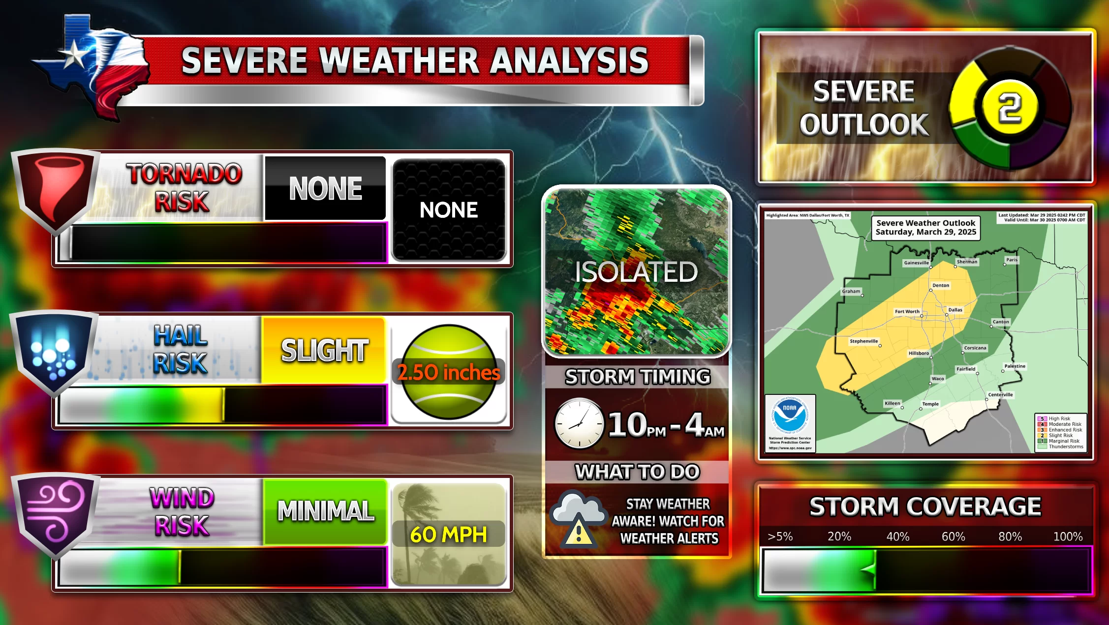
Hello everyone once again. Tomorrow is Sunday and it could be a very active Sunday of storms. Severe Weather is possible tomorrow beginning around 5:00-6:00 PM and the main wave of storms coming through the night into Monday morning. Hail and Tornadoes are the biggest risk right now for the DFW area. Let’s dive in more…
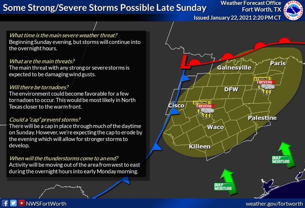
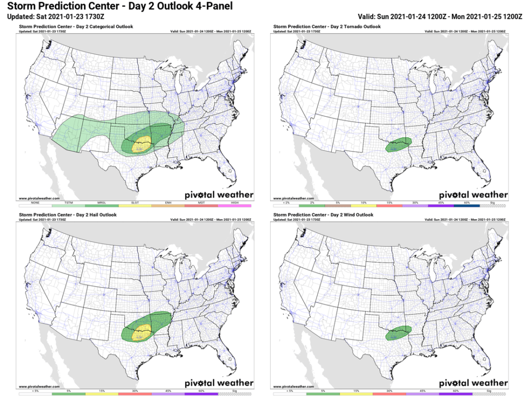
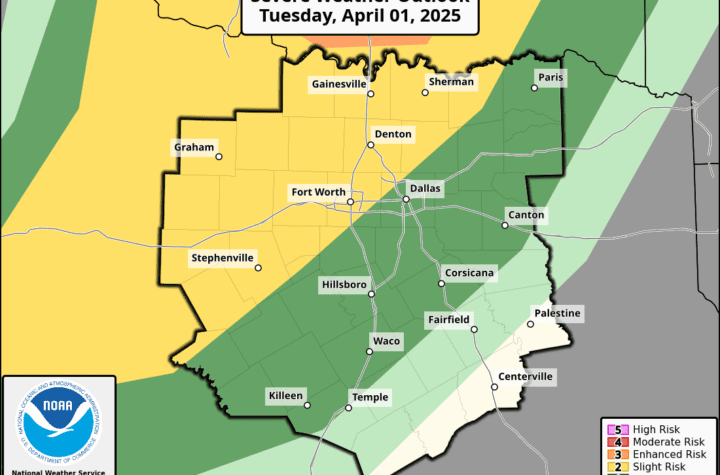
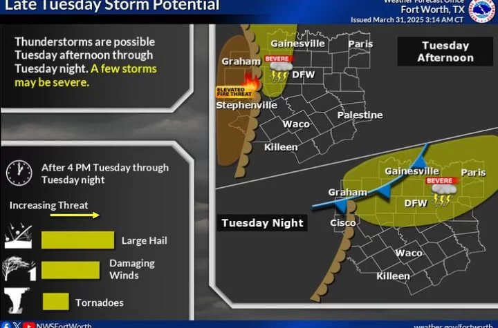
Above is a description of the storms from NOAA possible and the convective outlook of the storms. If you don’t know what a convective outlook is or want more SPC data, go HERE!
As you can see DFW is under the slight risk, and that hail is the biggest risk with tornadoes second biggest. The biggest thing is just try not to travel at this time. Stay home and weather aware because out in the dark during hail and/or tornado-favorable-conditions is just not fun nor safe.
Storm Timing
The first wave could come around 5-6 PM and could contain some hail. The second wave will be not long after, which is where the tornado risk comes in because the warm and cold front will be meeting very close to DFW then and areas closest to the warm front boundary would see the most tornado favorable conditions. That are would be Northern DFW into McKinney and Denton areas. The final wave could be over night with just some heavy rain and maybe some hail. Stay Weather Aware…
Live Storm Updates
Become a TWC Member today for FREE!
Support Texas Weather Center
Join the TWC Membership through Patreon to show your support and keep TWC high quality and FREE!
Texas Weather Center Supporters
🥉Kathryn
🥇David Bass
🥉cslewis1234
🥉Robert Fasulo
🥈Carol
Join TWC’s Facebook Group to interact with a community, see the latest updates from TWC, and share your weather photos!
