Hello! Welcome to a quick little blog here! WC would like to announce that its blog pages are now all full width content. This means that there will be no sidebar on blog posts. This overall could reduce confusion, simplify the site, and reduce page speed delays.
Now, WC has 3 main things it would like to address here. First, if you haven’t read Tornado Safety yet, wait no more! Read it now and learn all about tornadoes!
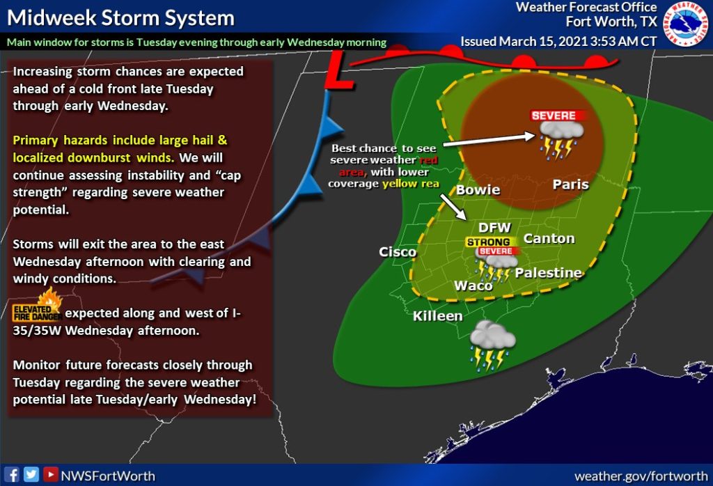
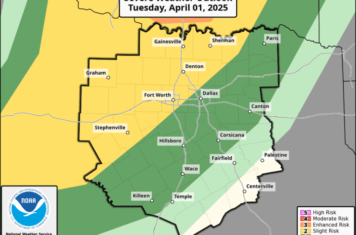
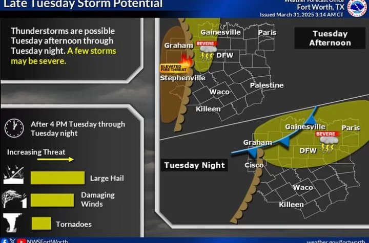
Second, regarding the severe weather potential, there is a risk for some bad weather as you can see above on late Tuesday night into very early Wednesday morning for the DFW area. Mostly areas in northern DFW will get the storm but it is not completely sure at this moment. Hail is the biggest risk with this squall line that will move in around 2-3 am for most people on Wednesday morning. Stay tuned! The risk remains marginal, still fairly low and non-threatening for most. Join WC’s Severe Weather Discussion Group to stay informed!
RISK HAS BEEN UPGRADED TO A SLIGHT
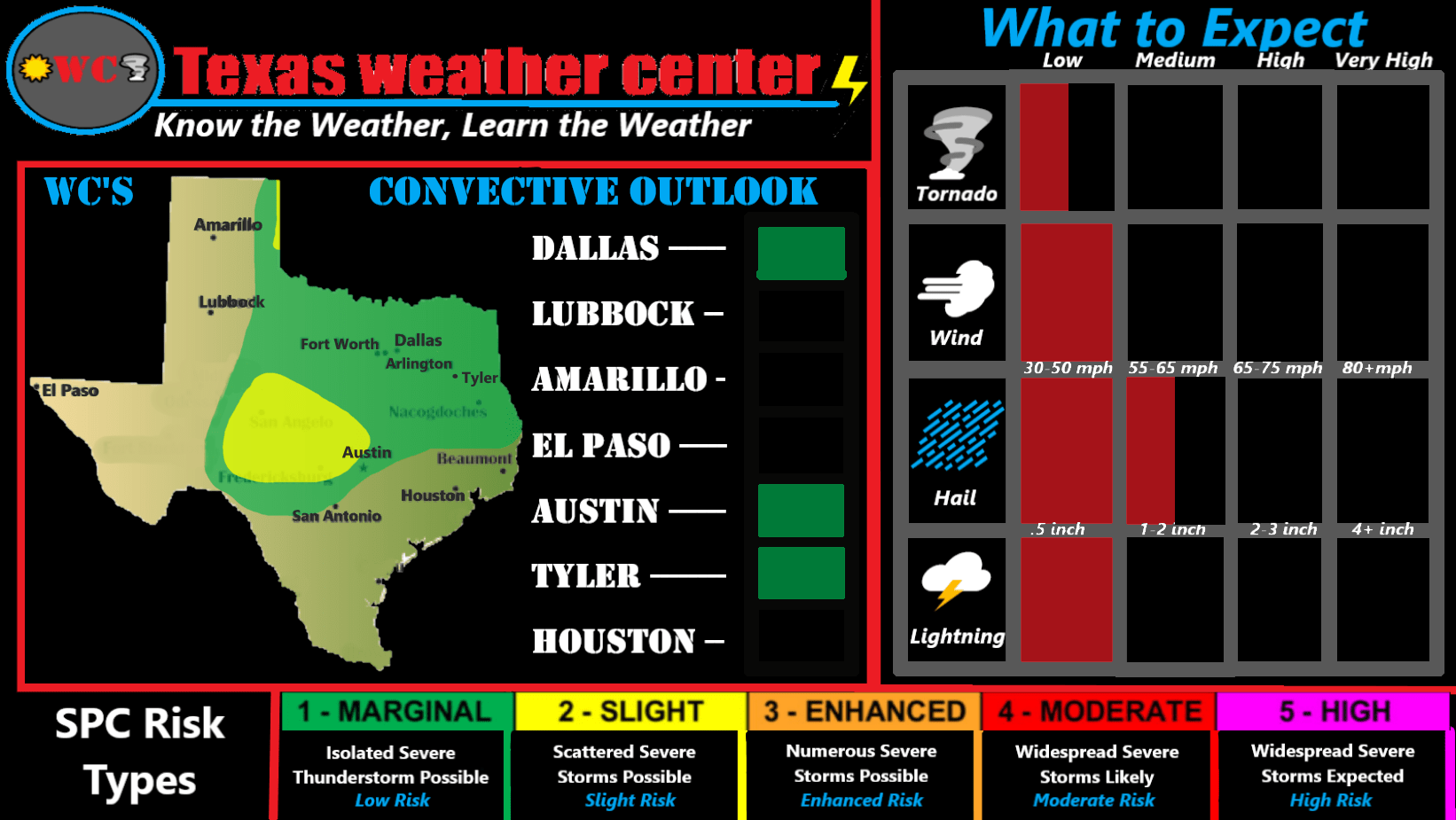
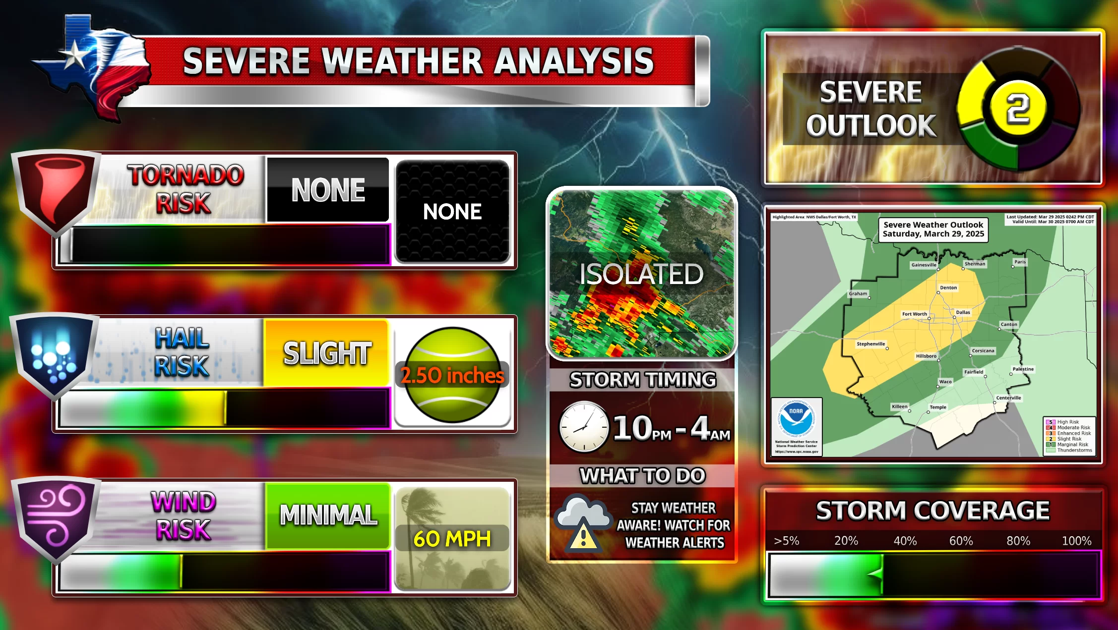
Third, WC as you may have noticed has created its own models for severe weather season now. Keep in mind that the convective outlooks are done by WC and are not exact to SPC’s outlooks. WC uses SPC data and other sources in this model as well. Additionally when it says “What to Expect”, this is a data sheet referring to what many could see in DFW, not all of Texas. Feel free to share this image with a link to Texas Weather Center to your friends and family!
Become a TWC Member today for FREE!
Support Texas Weather Center
Join the TWC Membership through Patreon to show your support and keep TWC high quality and FREE!
Texas Weather Center Supporters
🥉Kathryn
🥇David Bass
🥉cslewis1234
🥉Robert Fasulo
🥈Carol
Join TWC’s Facebook Group to interact with a community, see the latest updates from TWC, and share your weather photos!
