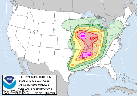
A widespread severe weather outbreak and tornado outbreak is expected for much of the mid-south mid-Mississippi valley region today. SPC has issued a HIGH risk for two split areas in this region. As some of you may know, high risks are rarely issued by SPC. These are only issued for particularly very dangerous storm systems.
This region could see a few strong to violent long-track tornadoes, very large hail, and damaging winds of 80+ MPH. Please, if you live in this area, stay extremely weather aware and know the dangers that are over your area today.
High Risk Storm Prediction Center Summary

Tornado Safety
Know the dangers of tornadoes before severe weather strikes your area! Learn about Tornado Safety today so you can be better prepared for when severe weather comes.
—
Become a TWC Member today for FREE!
Support Texas Weather Center
Join the TWC Membership through Patreon to show your support and keep TWC high quality and FREE!
Texas Weather Center Supporters
🥉Kathryn
🥇David Bass
🥉cslewis1234
🥉Robert Fasulo
🥈Carol
Join TWC’s Facebook Group to interact with a community, see the latest updates from TWC, and share your weather photos!


