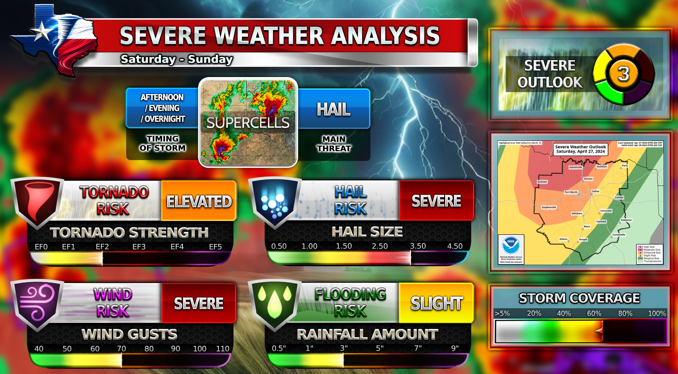
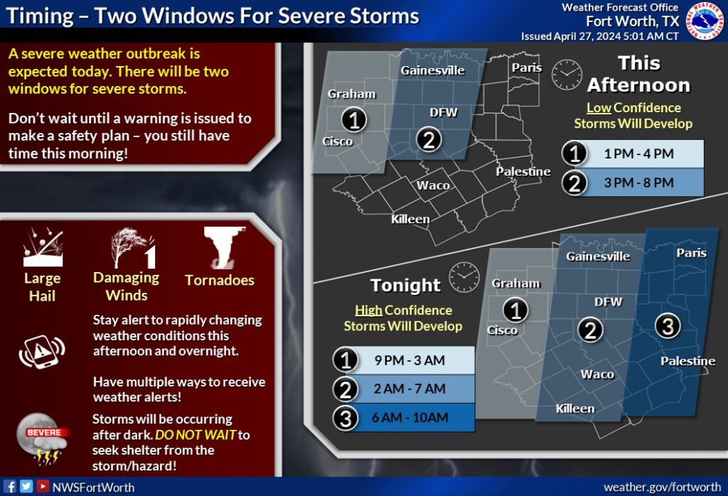
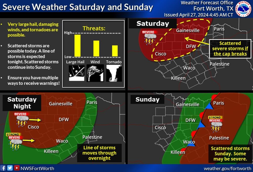
Severe weather threat has increased for today. Very large hail, damaging winds, and tornadoes are all possible. There will be two rounds of storms.
The first round is from 3PM – 8PM and is less likely because the cap is expected to hold. If the cap does break, very large hail and tornadoes will be possible.
The second round will be overnight between 2AM – 7AM. This has a very high chance of occurring for DFW. Storms will pass over DFW as a squall line with large hail and a few embedded spin-up tornadoes all being possible.
3️⃣Enhanced Risk
![]() Chance of a few Tornadoes
Chance of a few Tornadoes![]() Very large hail up to 3.5 Inches possible
Very large hail up to 3.5 Inches possible![]() Damaging winds up to 70 MPH
Damaging winds up to 70 MPH
Become a TWC Member today for FREE!
Support Texas Weather Center
Join the TWC Membership through Patreon to show your support and keep TWC high quality and FREE!
Texas Weather Center Supporters
🥉Kathryn
🥇David Bass
🥉cslewis1234
🥉Robert Fasulo
🥈Carol
Join TWC’s Facebook Group to interact with a community, see the latest updates from TWC, and share your weather photos!
