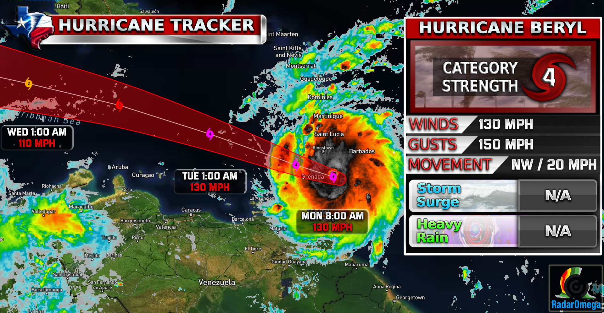
#Beryl continues strong as a CAT 4 hurricane, approximately 40 miles away from a potential landfall on the Windward Islands. Beryl currently is producing 130 MPH sustained winds with 150-155 MPH gusts along with an extremely low pressure of 959 MB.
Beryl is still expected to weaken slightly down to a CAT 2 hurricane before potentially making landfall on the Yucatan Peninsula where most models are showing. This would happen most likely early on Friday (7/5).
The question I’ve been getting a lot is, “Will Beryl hit the US?” The answer to that is still unknown. It is too far out to know for certain if Beryl will make landfall in the states and if so, how strong it will be. There are a wide range of paths it can take based on simulated weather models and the data is too spread out as of now to pinpoint anything. More data will come out in the next 2 days that will provide us a better understanding of what the US could see with #Beryl!
Follow WC’s Facebook or follow WC live on this page below for constant updates on Hurricane Beryl!
Continue to follow for more updates on Beryl and as always stay weather aware.
Become a TWC Member today for FREE!
Support Texas Weather Center
Join the TWC Membership through Patreon to show your support and keep TWC high quality and FREE!
Texas Weather Center Supporters
🥉Kathryn
🥇David Bass
🥉cslewis1234
🥉Robert Fasulo
🥈Carol
Join TWC’s Facebook Group to interact with a community, see the latest updates from TWC, and share your weather photos!
