UPDATE #4
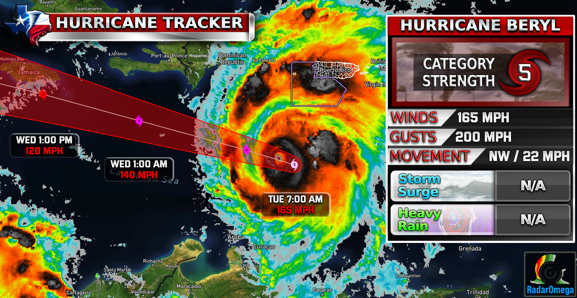
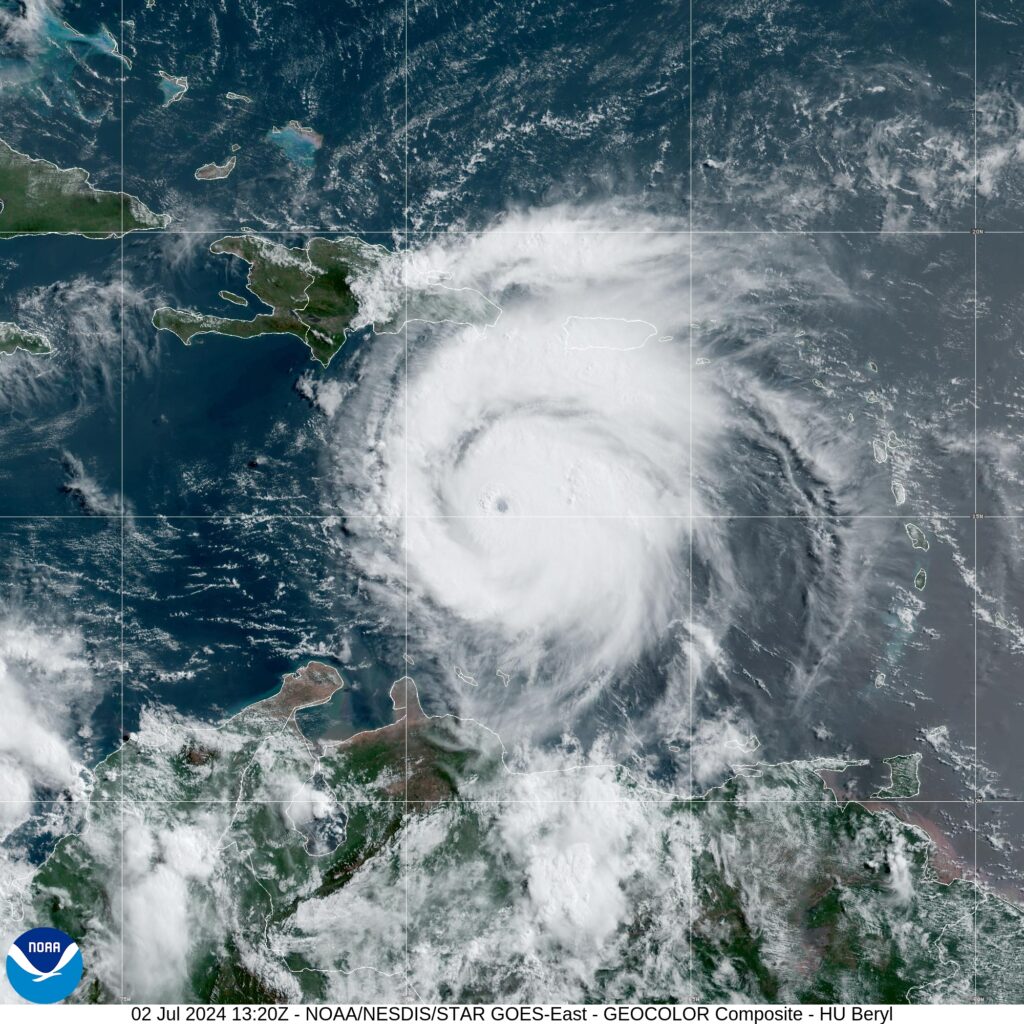
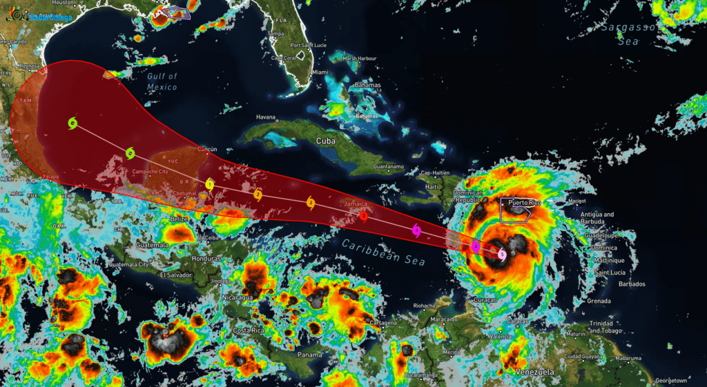
Good morning everyone! Yesterday night, #beryl made history as the earliest Cat 5 hurricane of a season on record. Beryl still remains a CAT 5 with winds of 165 MPH, gusts of 200 MPH, and a minimum core pressure of 934 mb!
Beryl on Monday made its first landfall on Carriacou Island and brought dangerous storm surge and extreme winds to the Windward Islands. Beryl’s next possible target appears to be Jamaica. Beryl will weaken as it enters into an area of high wind shear but is still expected to make landfall on the Yucatan Peninsula by early Friday morning as a CAT 1 hurricane.
The latest Spaghetti Models indicate Beryl will possibly follow a northern track toward the south Texas coastline. It is unclear how strong Beryl will be if it does make landfall. What we do know is that Beryl is expected to be a tropical storm by the time it enters the Gulf after crossing the Yucatan. If conditions are favorable, Beryl could strengthen again.
At this time there are simply too many unknowns to make any concrete forecasts. Stay weather aware!

Become a TWC Member today for FREE!
Support Texas Weather Center
Join the TWC Membership through Patreon to show your support and keep TWC high quality and FREE!
Texas Weather Center Supporters
🥉Kathryn
🥇David Bass
🥉cslewis1234
🥉Robert Fasulo
🥈Carol
Join TWC’s Facebook Group to interact with a community, see the latest updates from TWC, and share your weather photos!