UPDATE #5
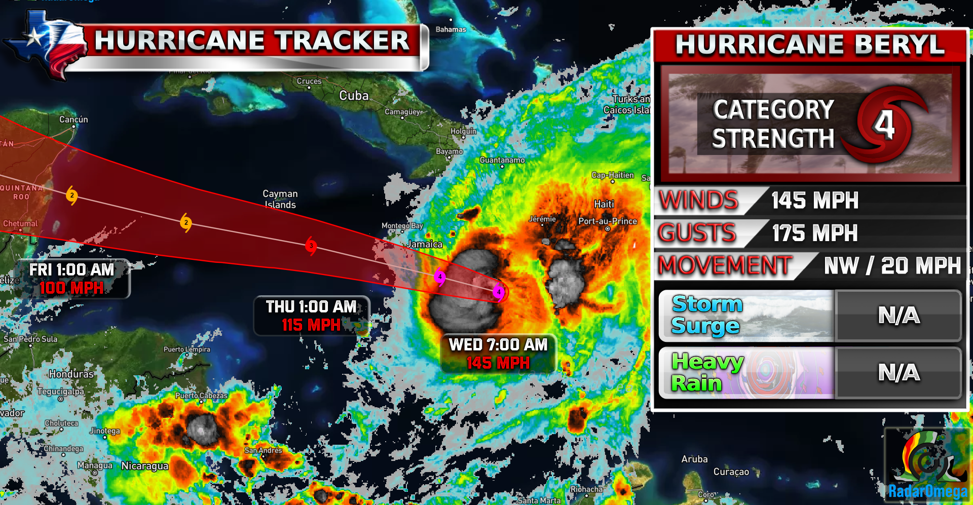
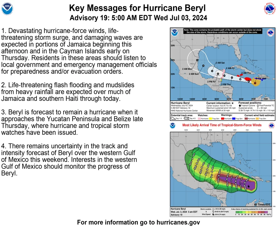
It’s another day of tracking #beryl everyone! Beryl has downgraded to a CAT 4 with winds of 145 MPH, gusts of 175 MPH, and a minimum core pressure of 952 mb. Beryl will continue to weaken as it moves into an area containing some significant wind shear which is bad for hurricanes.
Impacts to Jamaica are starting now! Beryl will pass just a few miles south of Jamaica missing a landfall but still causing hurricane-force winds, heavy rain, and life-threatening storm surge.
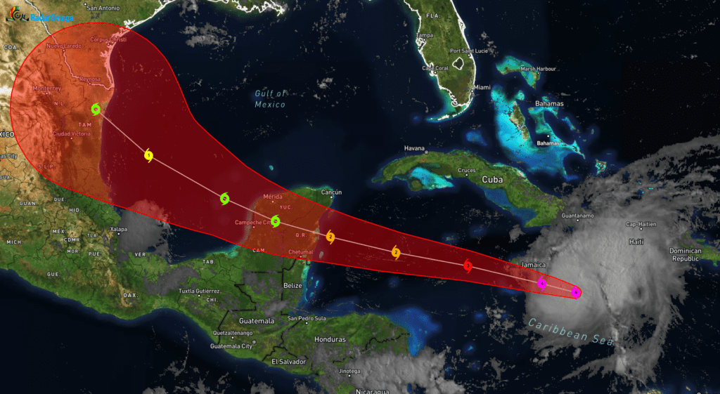
After Jamaica, Beryl will continue to weaken down to a CAT 2 until it is expected to make landfall on the Yucatan Peninsula by early Friday morning around 1-8 AM.
The latest Spaghetti Models show increased confidence for a northern track towards the south Texas coastline near the South Padre / Brownsville area. It is still unclear how strong Beryl will be on its potential journey towards Texas but some models are indicating a CAT 1 or CAT 2 as of now. The timing for a potential landfall would be anywhere between Sunday – Tuesday next week.
Since we are still a while out for a potential landfall for the US, there are still uncertainties on the location of landfall and intensity of Beryl!
Stay weather aware!

Become a TWC Member today for FREE!
Support Texas Weather Center
Join the TWC Membership through Patreon to show your support and keep TWC high quality and FREE!
Texas Weather Center Supporters
🥉Kathryn
🥇David Bass
🥉cslewis1234
🥉Robert Fasulo
🥈Carol
Join TWC’s Facebook Group to interact with a community, see the latest updates from TWC, and share your weather photos!