UPDATE #7
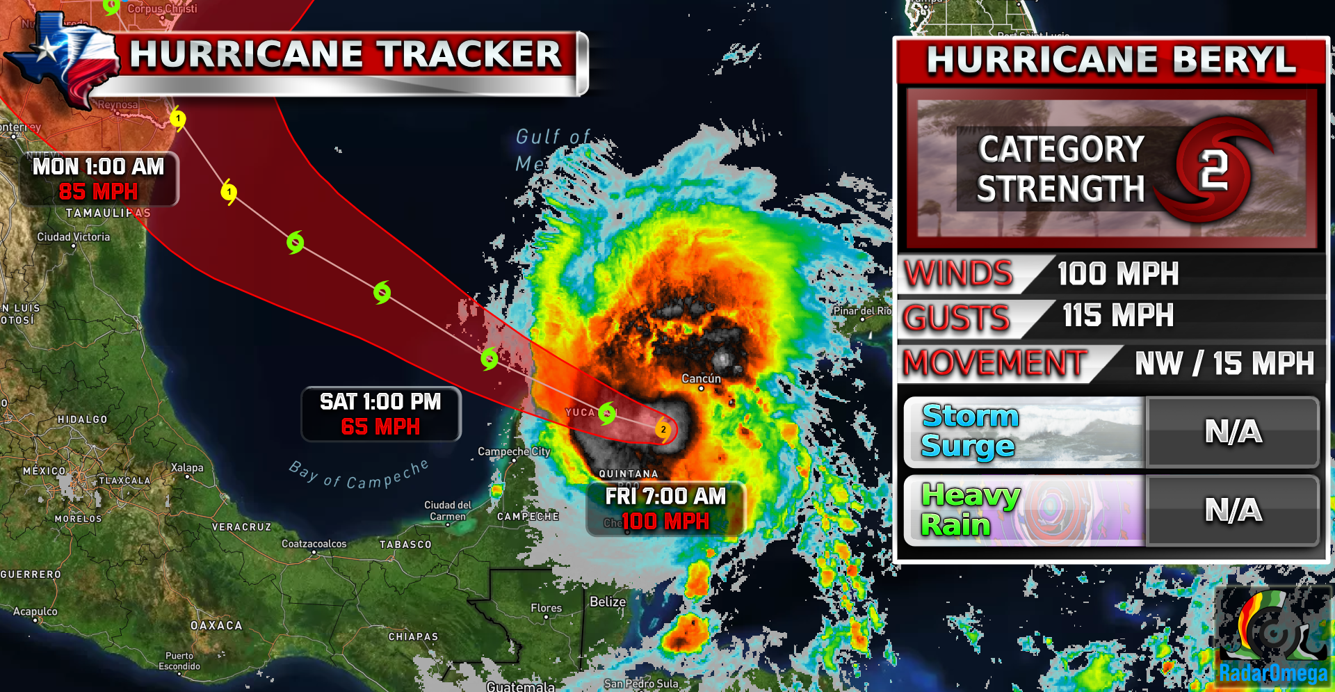
#beryl made landfall on the Yucatan Peninsula early this morning as a strong CAT 2 hurricane! As Beryl travels over the land of the Yucatan, it will rapidly decrease in strength and lose its shape.
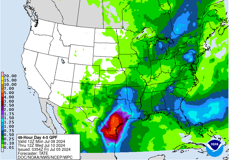
The latest National Hurricane Center models now have the hurricane track over South Padre / Brownsville Texas as the forecasted landfall location. It is forecasted to make landfall late Monday night into early Tuesday morning as a strong CAT 1 which could potentially become a CAT 2 if Beryl has enough time to restrengthen.
Hurricane watches are likely to be issued for South Texas very soon today along with storm surge forecasts. Rainfall is expected to be 5-7 inches in South Texas and North Texas could receive up to 1-1.5 inches of rain because of Beryl.
Stay weather aware!
Become a TWC Member today for FREE!
Support Texas Weather Center
Join the TWC Membership through Patreon to show your support and keep TWC high quality and FREE!
Texas Weather Center Supporters
🥉Kathryn
🥇David Bass
🥉cslewis1234
🥉Robert Fasulo
🥈Carol
Join TWC’s Facebook Group to interact with a community, see the latest updates from TWC, and share your weather photos!
