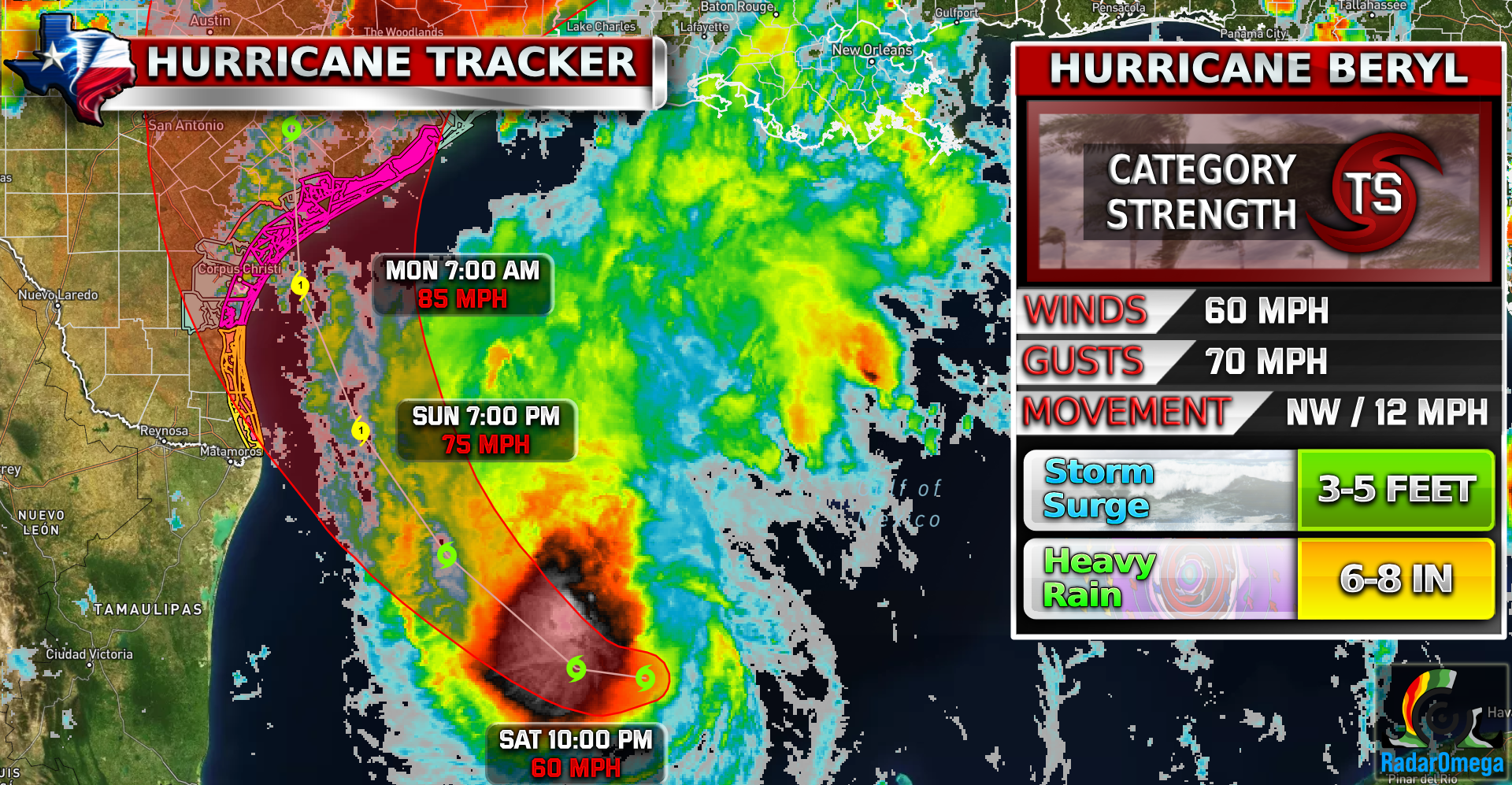
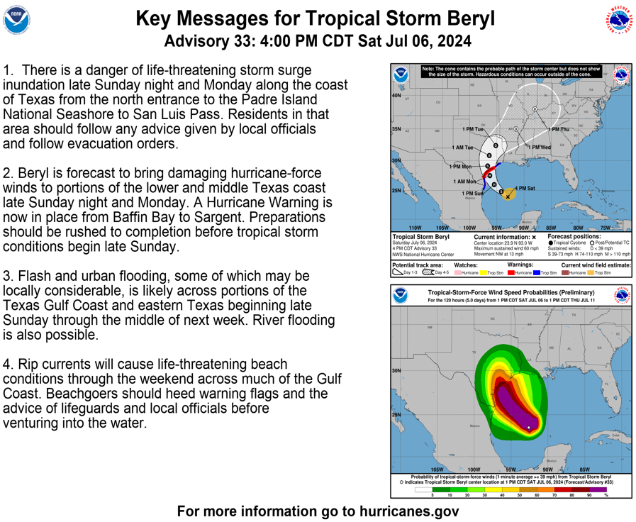
#Beryl is now less than 48 hours from landfall in Texas! Beryl is forecasted to make landfall around Port Lavaca, just east of Corpus Christi. The exact area for landfall is subject to change up to 50 miles. It is forecasted to make landfall sometime on Monday as a strong CAT 1 but Sunday will be a big day to determine if it can restrengthen faster and reach a CAT 2 or even a CAT 3 if Beryl slows down and stalls out.
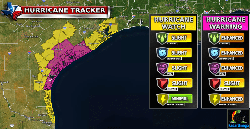
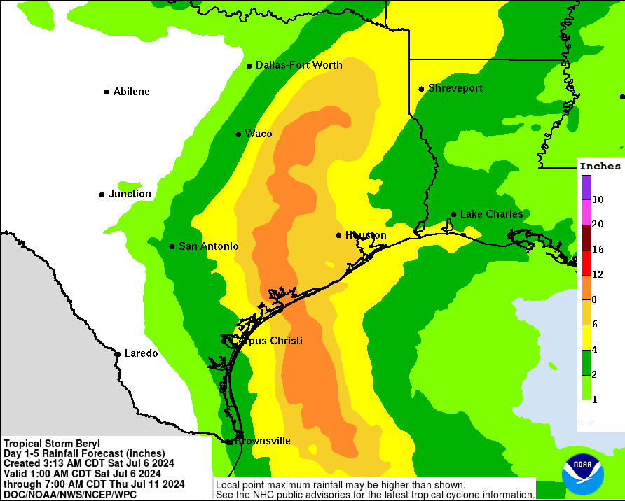
Anyone on the Texas coastline needs to be on high alert! Flooding from storm surge and heavy rain is likely across much of the Texas coastline currently under Hurricane and Tropical Storm Warnings.
Rainfall totals could be around 6-8 inches and storm surge of 4-6 feet in areas under Hurricane Warnings are possible.
Stay weather aware! More updates coming soon as TWC closely monitors this storm. Feel free to ask questions you may have about #Beryl!
Become a TWC Member today for FREE!
Support Texas Weather Center
Join the TWC Membership through Patreon to show your support and keep TWC high quality and FREE!
Texas Weather Center Supporters
🥉Kathryn
🥇David Bass
🥉cslewis1234
🥉Robert Fasulo
🥈Carol
Join TWC’s Facebook Group to interact with a community, see the latest updates from TWC, and share your weather photos!
