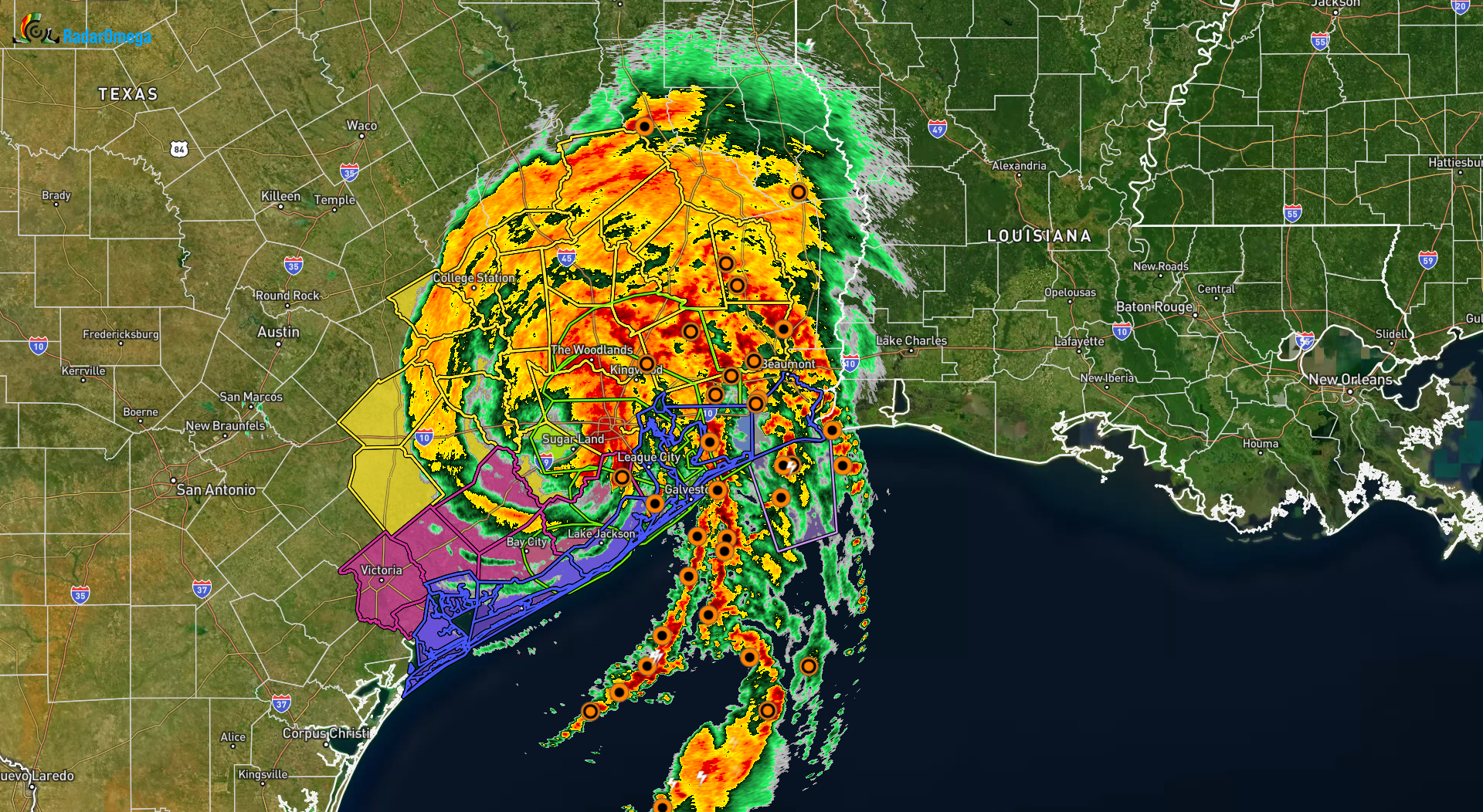
What a night. Hurricane Beryl made landfall near Matagorda, TX (85 miles southeast of Houston, TX) as a CAT 1 hurricane with sustained winds of 80 MPH and gusts of 100 MPH. #beryl brought a storm surge of around 3-5 feet with up to 7 feet in some areas along with torrential rainfall that is continuing as we speak.
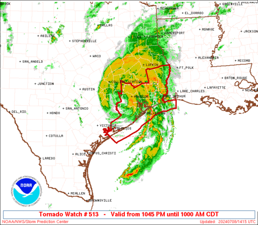
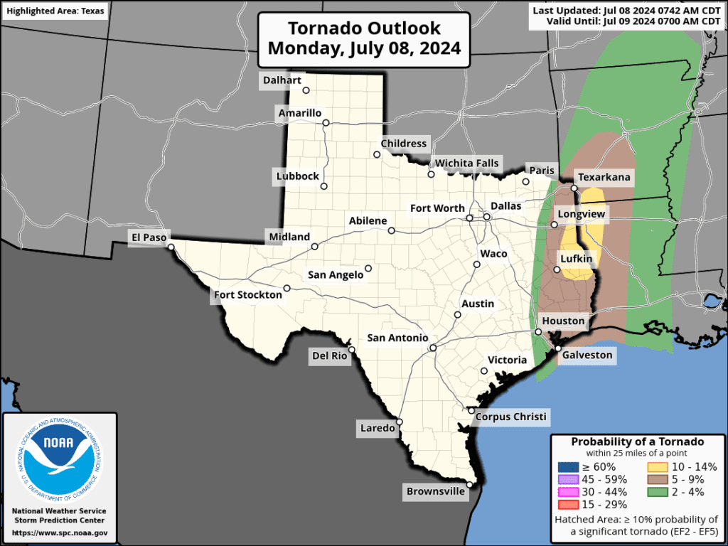
Tornadoes are also a big issue right now with Beryl as the intense rain bands spin around from the eastern side of the eye. Because of the rapid circulation that occurs with hurricanes, tornadoes are often found embedded within the squalls (hurricane rain bands). A tornado watch remains in effect for all of Houston and Galveston, and extends up close to Lufkin, TX.
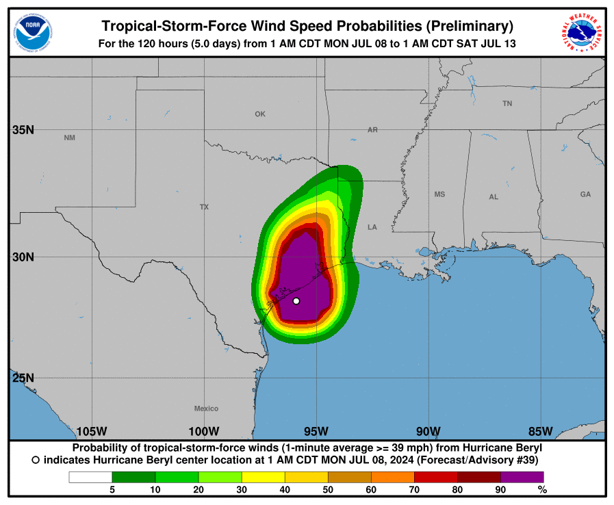
There are almost 2 million customers without power because of the violent winds and water that moved ashore overnight. TWC expects that number to grow as beryl continues to pour down rain and move northward. As you can see in the Tropical-Storm Force Wind graphic, the wind field is quite large which means many far inland will experience winds near tropical storm force (55-74 MPH)
Stay weather aware. More updates coming later on rain totals here for North Texas and updates on #Beryl
Share below if you were in the path!

Become a TWC Member today for FREE!
Support Texas Weather Center
Join the TWC Membership through Patreon to show your support and keep TWC high quality and FREE!
Texas Weather Center Supporters
🥉Kathryn
🥇David Bass
🥉cslewis1234
🥉Robert Fasulo
🥈Carol
Join TWC’s Facebook Group to interact with a community, see the latest updates from TWC, and share your weather photos!
