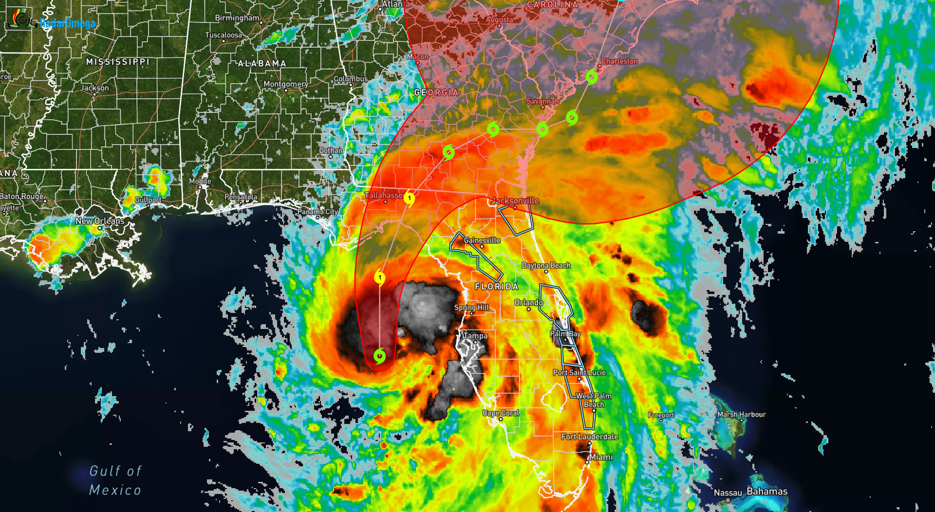
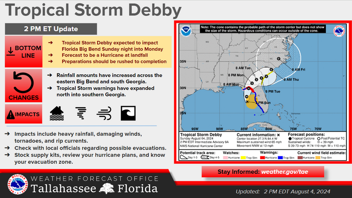
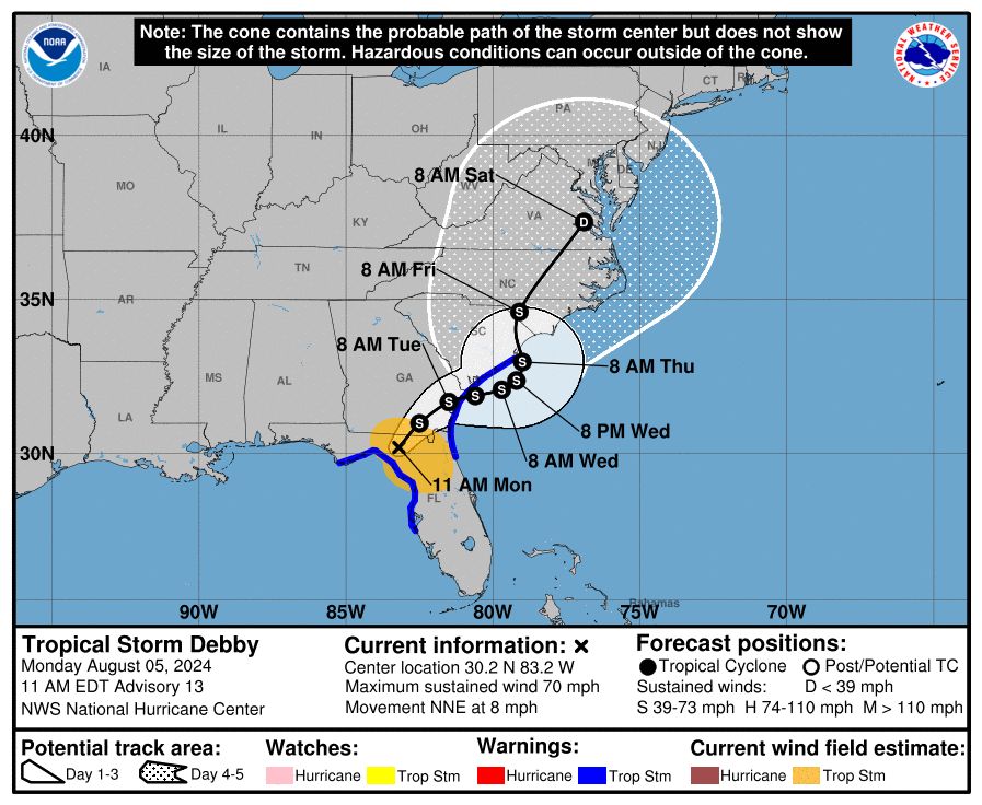
Tropical Storm Debby, which is nearly a hurricane, is sitting just off the coast of Florida. Rapid strengthening is forecasted for Debby in the next few hours, which will result in Debby becoming a CAT 1 hurricane by tonight, with additional strengthening likely before it reaches the Florida Big Bend coast on Monday afternoon.
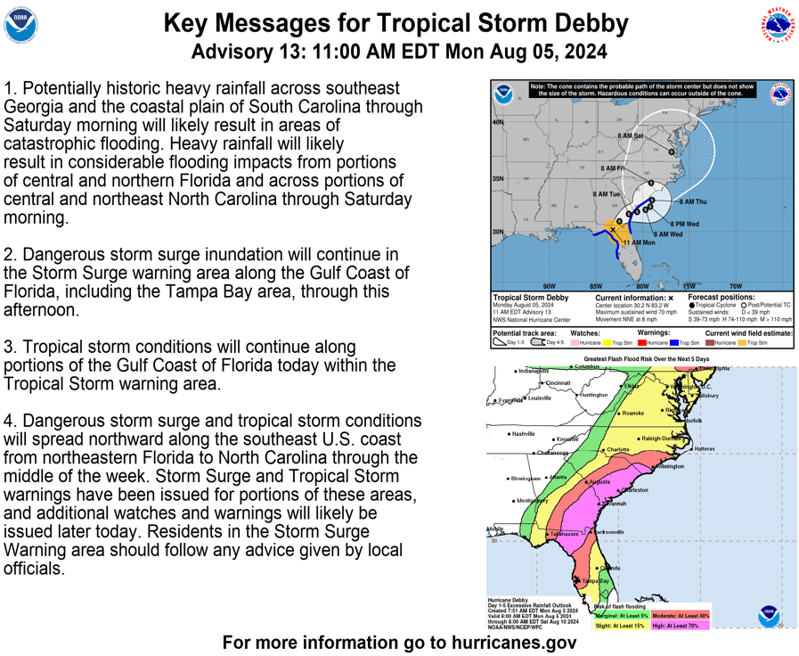
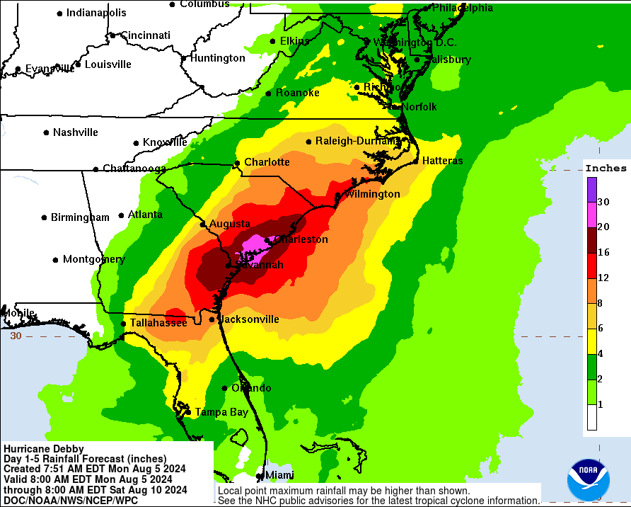
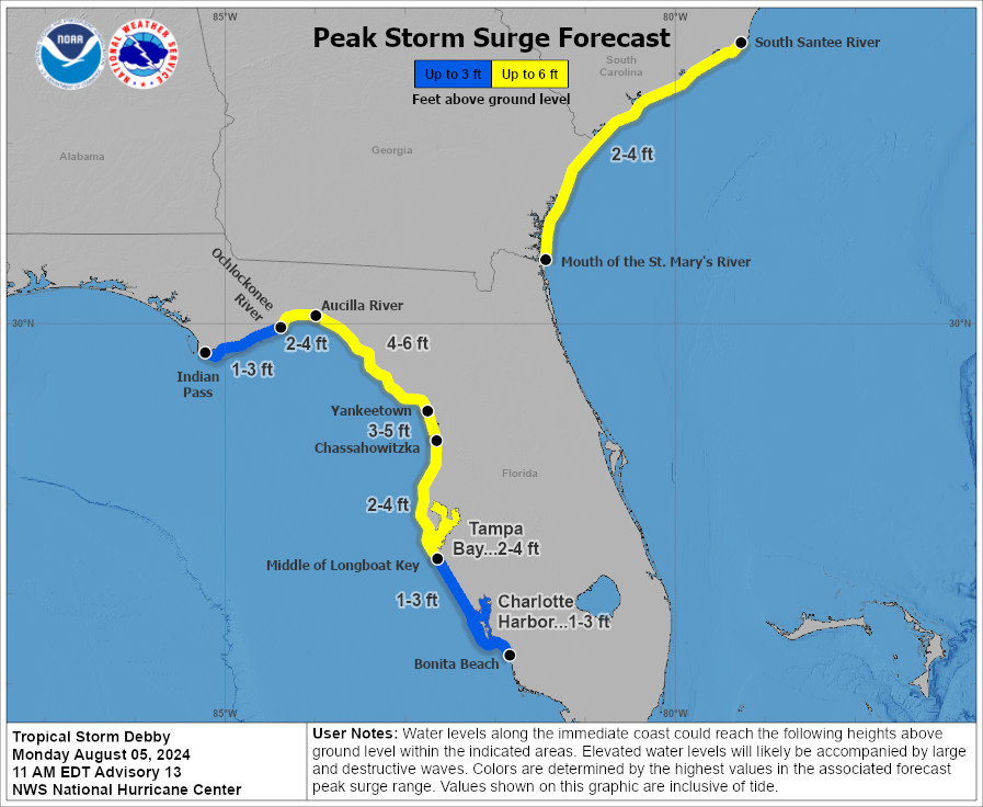
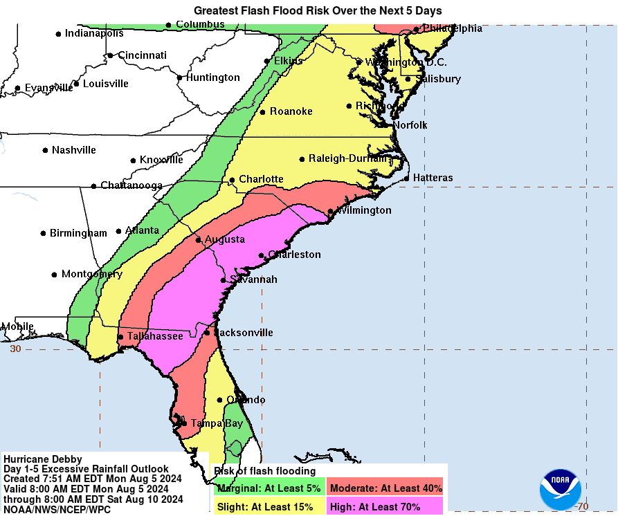
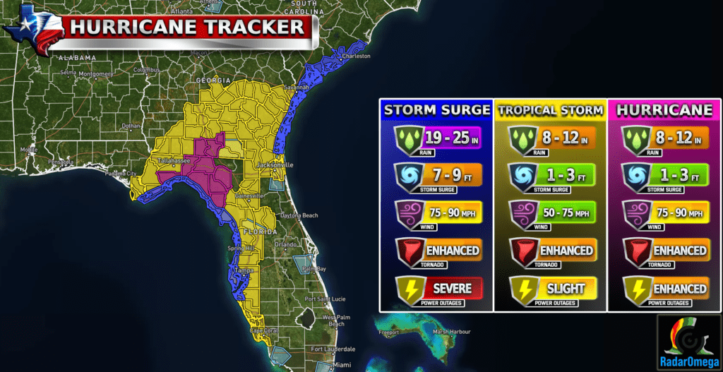
Potentially historic heavy rainfall across southeast Georgia and South Carolina through Friday morning will likely result in areas of catastrophic flooding. Heavy rainfall will likely result in considerable flooding impacts from the Florida Big Bend region through southeast GA and the Coastal Plain of the Carolinas through Friday. Rainfall up to 20-30 inches in some areas is possible Life-threatening storm surge of 7-10 feet in the worst areas is also possible
Hurricane conditions are expected Monday along portions of the Florida Big Bend region where a Hurricane Warning is in effect, with tropical storm conditions beginning this evening. Tropical storm conditions are expected through Monday farther south within the Tropical Storm Warning along Florida’s west coast, including the Tampa Bay area.
| Satellite Imagery
See the latest Satellite Imagery of the southern plains, the US, and the whole disk! See various types of imagery like infrared, water vapor, visible, and more!
Landfall
7:00 AM Monday
Current Intensity
CAT 1 / 75 MPH
Max Expected Intensity
CAT 1 / 85 MPH
Storm Movement
NE 10 MPH
Peak Storm Surge
7-10 FT
Max Rainfall Totals
20-30 Inches
| Rainfall Totals
| Peak Storm Surge
| Flash Flood Outlook
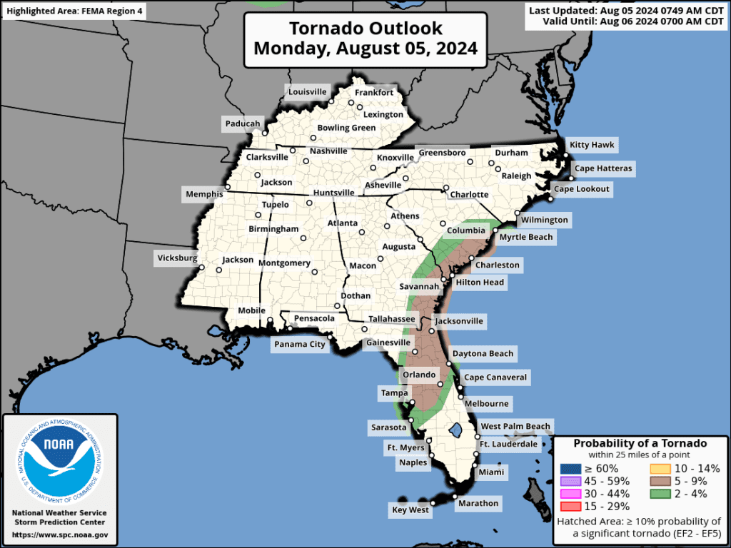
| Tornado Outlook
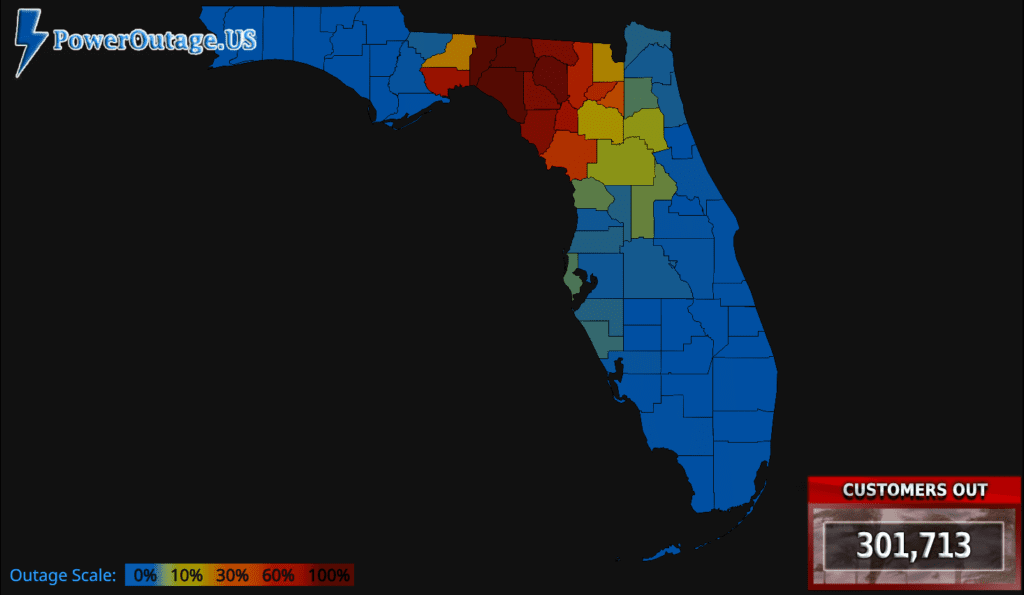
| TWC Info Maps
| TS Force Wind Probabilities
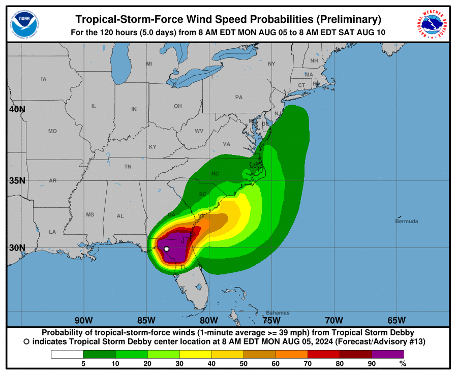
| Tracking Map
Become a TWC Member today for FREE!
Support Texas Weather Center
Join the TWC Membership through Patreon to show your support and keep TWC high quality and FREE!
Texas Weather Center Supporters
🥉Kathryn
🥇David Bass
🥉cslewis1234
🥉Robert Fasulo
🥈Carol
Join TWC’s Facebook Group to interact with a community, see the latest updates from TWC, and share your weather photos!
