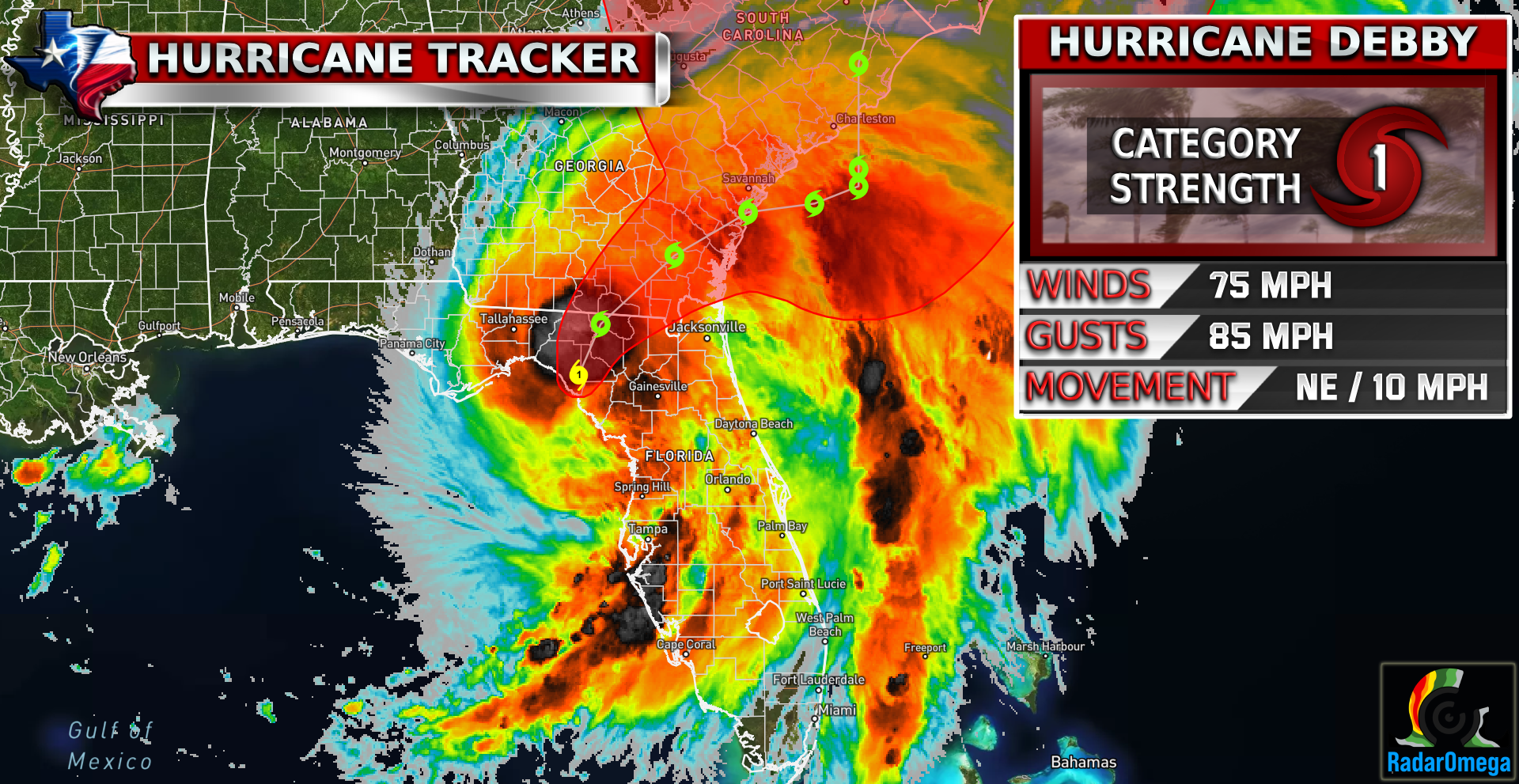
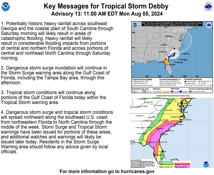
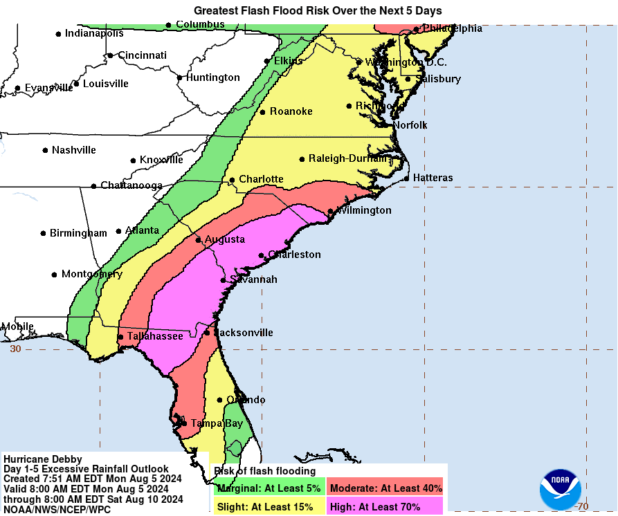
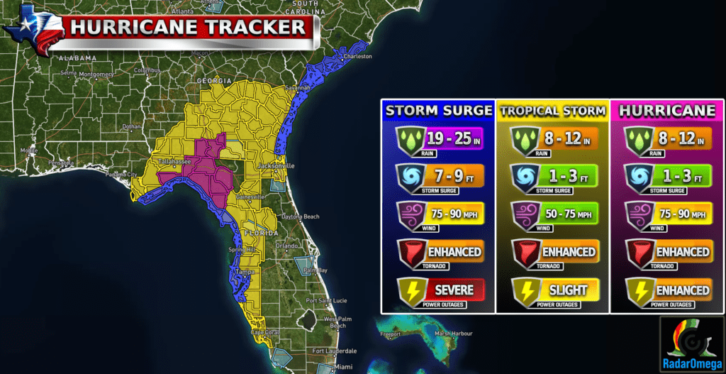
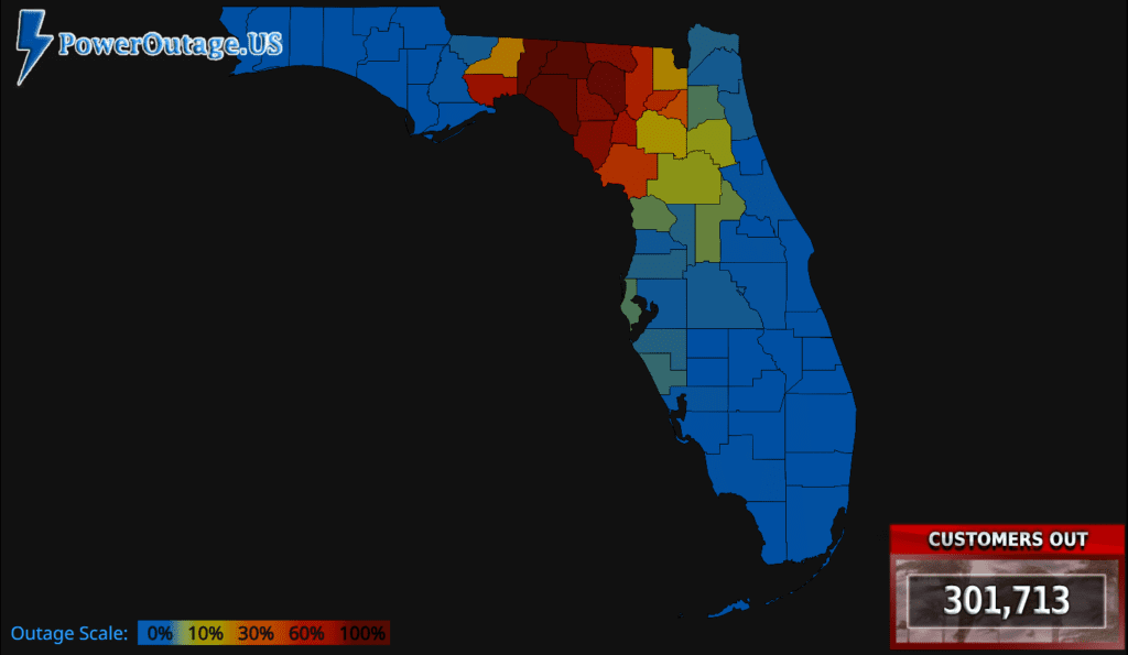
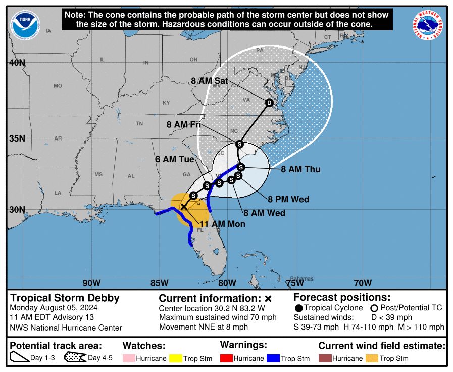
Hurricane Debby makes landfall near Steinhatchee Florida as a Category 1 with 80 mph winds with gusts over 100 mph. Storm surge and extreme rainfall is ongoing in much of Florida right now. Over 300,000 are without power as well all throughout the northern portions of Florida. Conditions will continue to worsen as Debby moves NE back into the Atlantic potentially by tomorrow afternoon. Stay weather aware!
| Satellite Imagery
See the latest Satellite Imagery of the southern plains, the US, and the whole disk! See various types of imagery like infrared, water vapor, visible, and more!
Landfall
7:00 AM Monday
Current Intensity
CAT 1 / 75 MPH
Max Expected Intensity
CAT 1 / 85 MPH
Storm Movement
NE 10 MPH
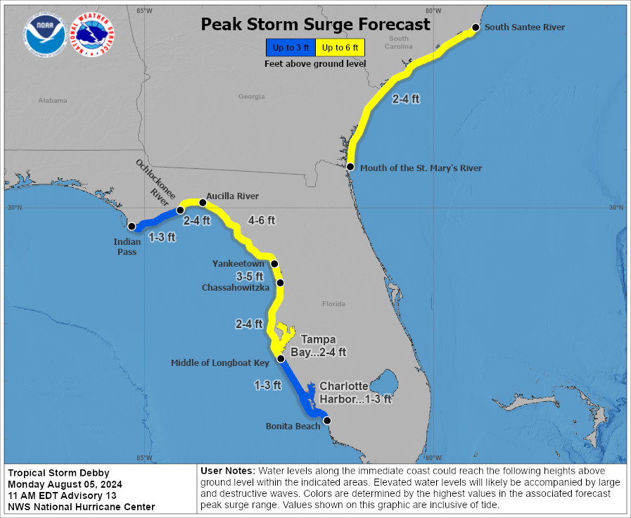
Peak Storm Surge
7-10 FT
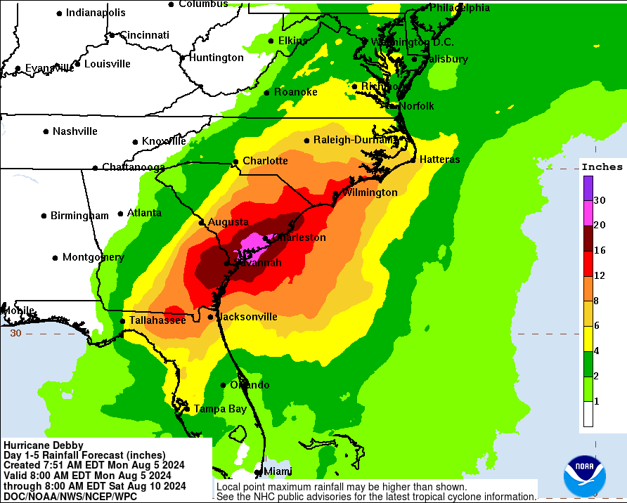
Max Rainfall Totals
20-30 Inches
| Rainfall Totals
| Peak Storm Surge
| Flash Flood Outlook
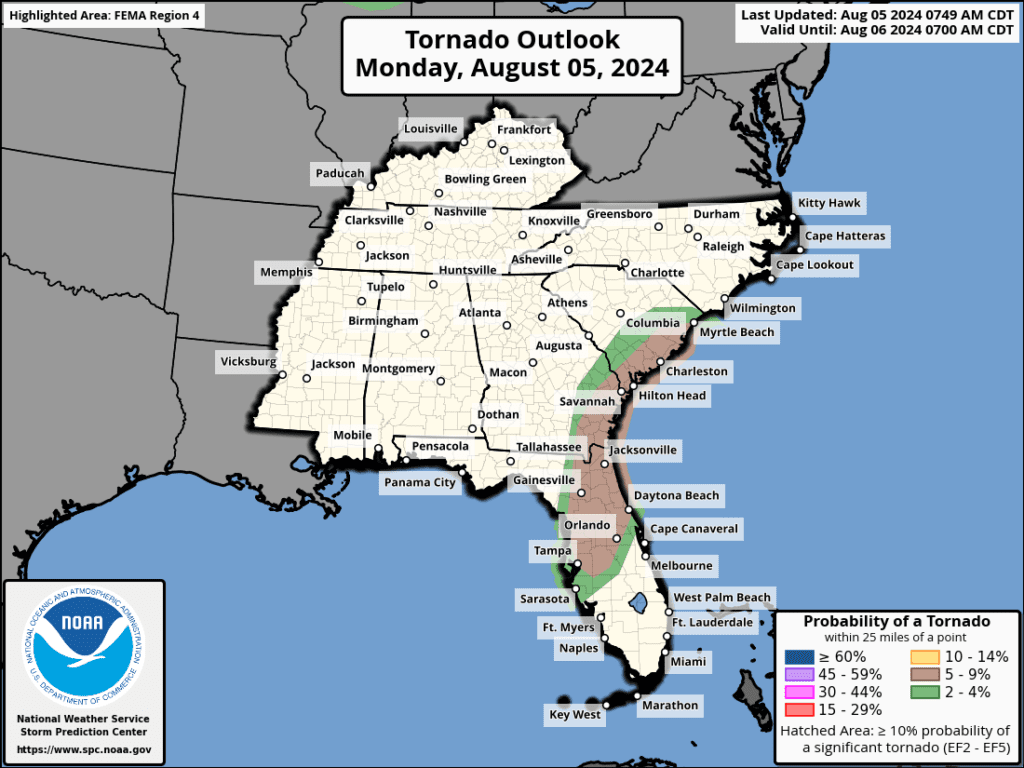
| Tornado Outlook
| TWC Info Maps
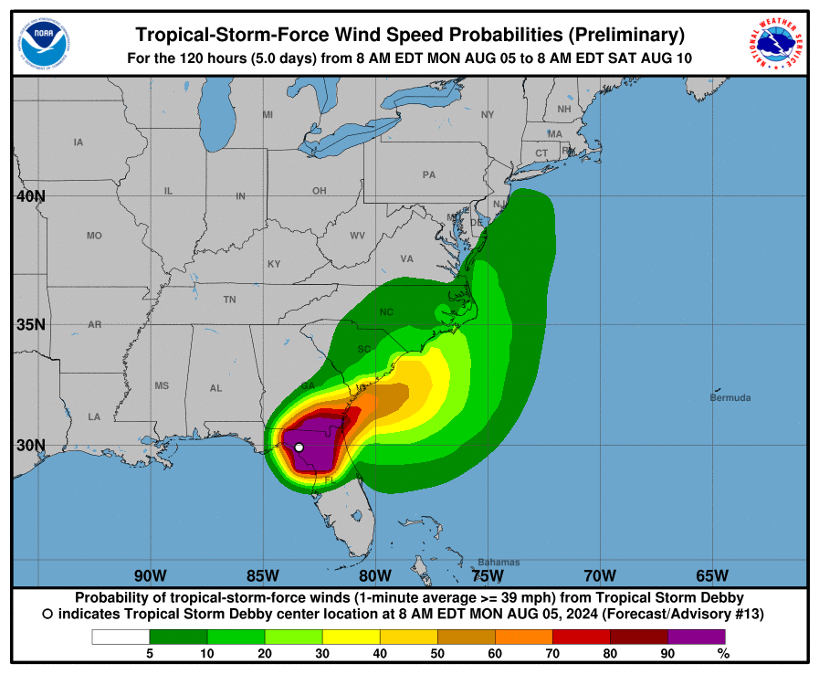
| TS Force Wind Probabilities
| Tracking Map
Become a TWC Member today for FREE!
Support Texas Weather Center
Join the TWC Membership through Patreon to show your support and keep TWC high quality and FREE!
Texas Weather Center Supporters
🥉Kathryn
🥇David Bass
🥉cslewis1234
🥉Robert Fasulo
🥈Carol
Join TWC’s Facebook Group to interact with a community, see the latest updates from TWC, and share your weather photos!
