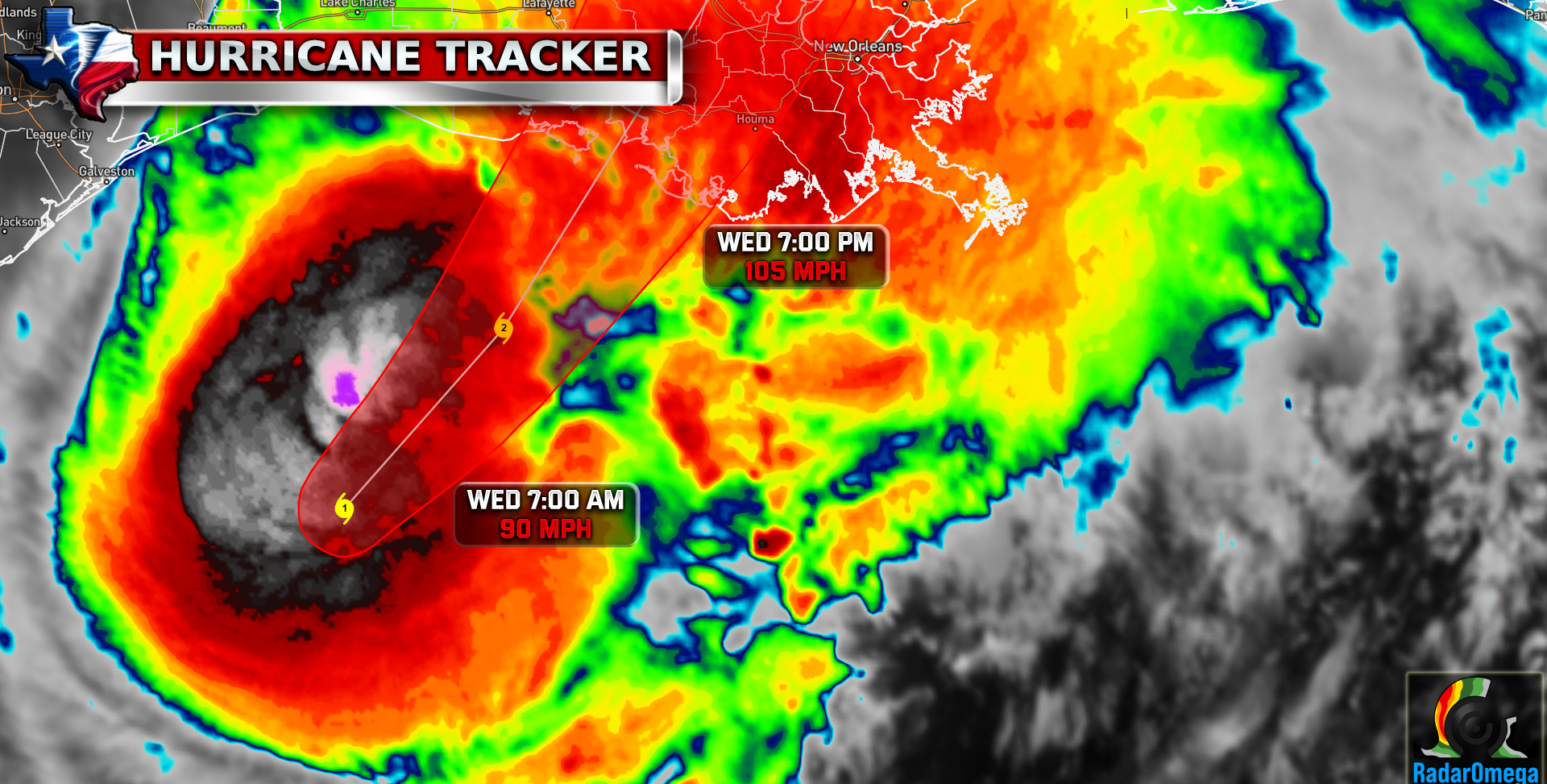
Hurricane Francine is just hours away from making landfall near Morgan City, Louisiana. Max winds are currently 90mph! Several feet of storm surge up to 7-10 feet will occur today and tonight along the eastern side of the storm.
1. There is a danger of life-threatening storm surge today for the Louisiana and Mississippi coastlines, where a Storm Surge Warning is in effect. Residents in the warning area should continue to follow the advice given by local officials.
2. Damaging and life-threatening hurricane-force winds are expected in portions of southern Louisiana later today, where a Hurricane Warning is in effect. Ensure you are in a safe location before the onset of strong winds or possible flooding.
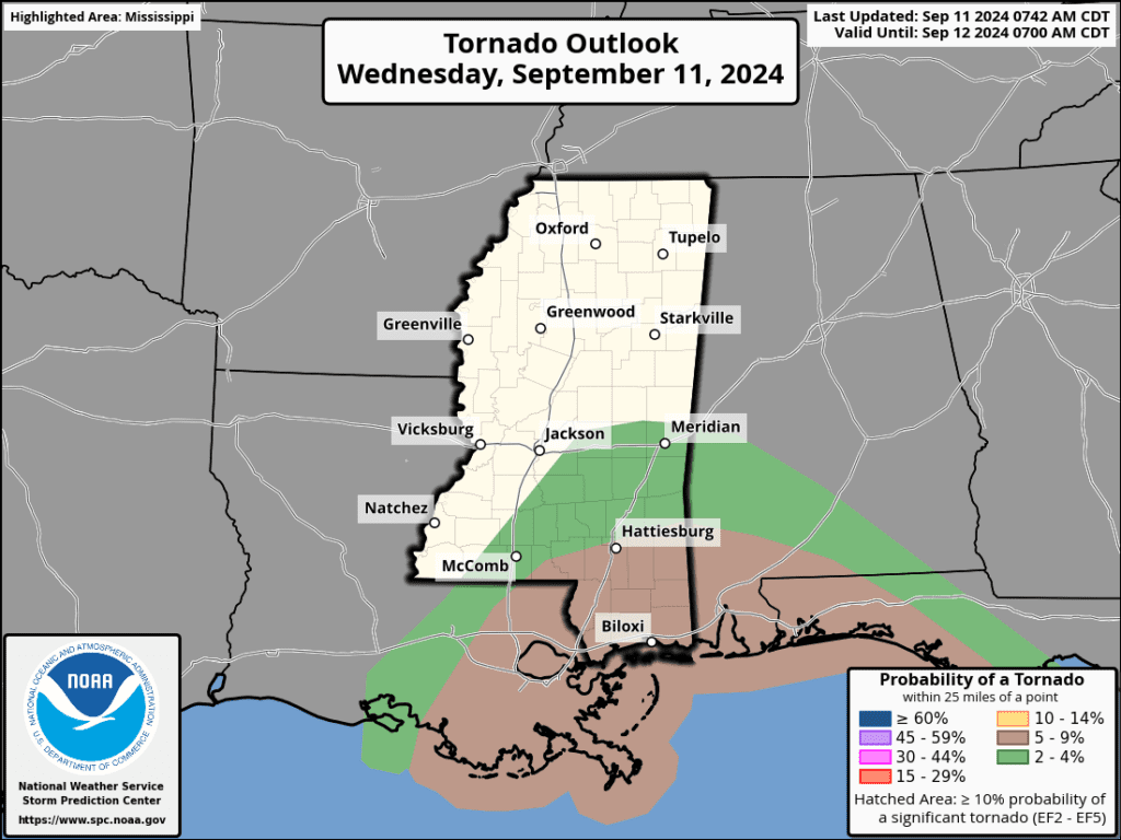
3. Francine is expected to bring heavy rainfall and the risk of considerable flash and urban flooding, along with river flooding, across southeastern Louisiana, Mississippi, far southern Alabama and the Florida Panhandle through Thursday night. Flash and urban flooding is probable across the Lower Tennessee Valley and Lower Mississippi Valley tonight into Friday morning.

| Satellite Imagery
See the latest Satellite Imagery of the southern plains, the US, and the whole disk! See various types of imagery like infrared, water vapor, visible, and more!
Landfall
5:00 PM Wednesday
Current Intensity
CAT 1 / 90 MPH
Max Expected Intensity
CAT 2 / 100 MPH
| Rainfall Totals

| Peak Storm Surge

| Flash Flood Outlook

| Tornado Outlook
| TWC Info Maps
")
")
| TS Force Wind Probabilities

| Hurricane Wind Probabilities

| Tracking Map

| Warnings / Surface Winds

| Latest IR Satellite Imagery

Become a TWC Member today for FREE!
Support Texas Weather Center
Join the TWC Membership through Patreon to show your support and keep TWC high quality and FREE!
Texas Weather Center Supporters
🥉Kathryn
🥇David Bass
🥉cslewis1234
🥉Robert Fasulo
🥈Carol
Join TWC’s Facebook Group to interact with a community, see the latest updates from TWC, and share your weather photos!