With September already halfway through, we are starting to see a pattern shift in the weather. More hurricanes and a temperature shift is expected in these coming weeks. Take a look…
Update on the Tropics
There are currently 2 points of interest in the tropics right now. The orange zone will likely develop into something soon but be stranded out in the Atlantic. The yellow zone, based on long-range weather models, could develop into something big towards the end of September.
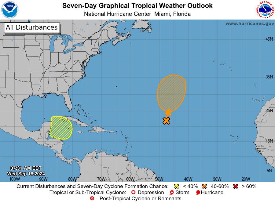
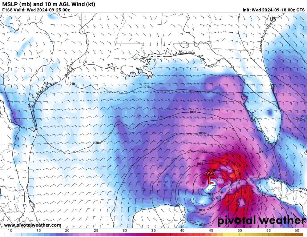
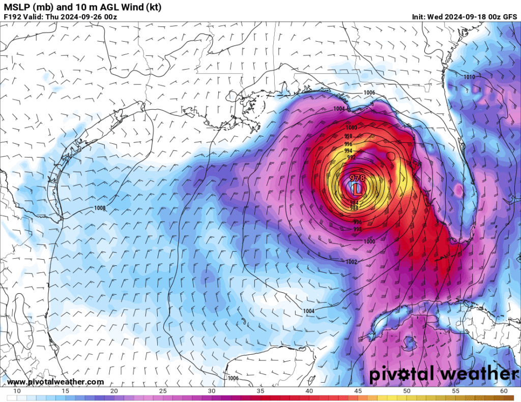
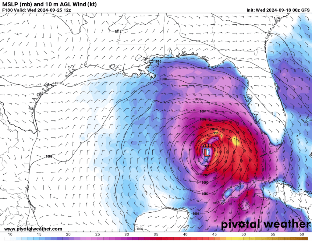
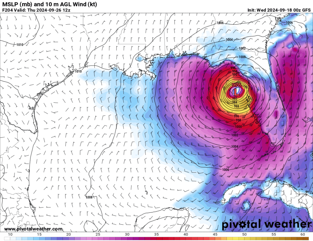
The GFS long-range weather model predicts a strong low-pressure system around September 25-26th that indicates a possible strong hurricane in the Gulf that could impact the eastern parts of the Gulf including Florida. Stay tuned as the models improve and NHC issues outlooks are released for these dates.
Wed 2024-09-25 00z
Thu 2024-09-26 00z
Wed 2024-09-25 12z
Thu 2024-09-26 12z
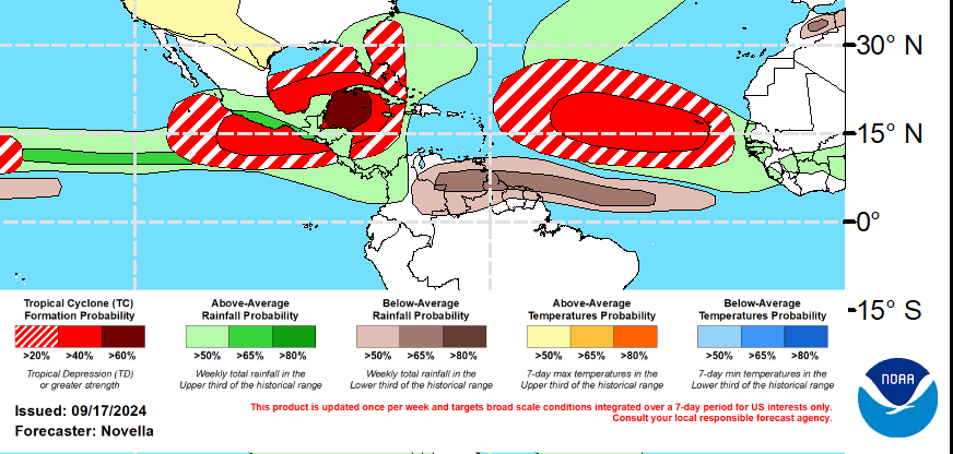
NOAA’s long-range global tropics outlook also indicates a strong storm to develop soon in the Caribbean. Stay weather aware.
Become a TWC Member today for FREE!
Support Texas Weather Center
Join the TWC Membership through Patreon to show your support and keep TWC high quality and FREE!
Texas Weather Center Supporters
🥉Kathryn
🥇David Bass
🥉cslewis1234
🥉Robert Fasulo
🥈Carol
Join TWC’s Facebook Group to interact with a community, see the latest updates from TWC, and share your weather photos!
