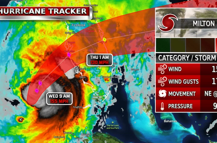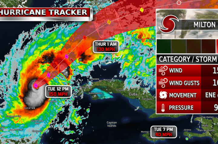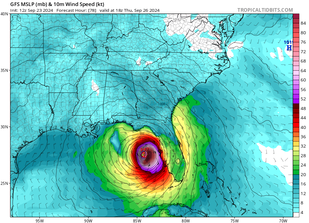
Long term weather models indicate a very strong Hurricane to form and hit Florida by Thursday afternoon. Models indicate a strong CAT 3 or weak CAT 4 at the moment due to rapid intensification that is expected to occur with this system over the next few days. The storm is expected to move very slowly the next couple days and speed up by Wednesday as it sets its course on its final destination. Keep in mind that these are ONLY MODELS, specific landfall and intensity of the hurricane is not narrowed down yet. But please do take precautions now, this could be a very serious storm for Florida, and if you live in the Florida area or know friends who do, please alert them immediately about this threat and make sure they take the necessary steps to ensure they stay safe.
More updates to come about Possible Tropical Cyclone Nine, soon to be Helene. Follow Texas Weather Center on Facebook for rapid updates on this storm

| Simulated Weather Models


| Satellite Imagery
See the latest Satellite Imagery of the southern plains, the US, and the whole disk! See various types of imagery like infrared, water vapor, visible, and more!
| 7-Day Tropical Weather Outlook

| Rainfall Totals

| TS Force Wind Probabilities

| Hurricane Wind Probabilities

| Tracking Map

| Spaghetti Models

| Warnings / Surface Winds

| Latest IR Satellite Imagery

Become a TWC Member today for FREE!
Support Texas Weather Center
Join the TWC Membership through Patreon to show your support and keep TWC high quality and FREE!
Texas Weather Center Supporters
🥉Kathryn
🥇David Bass
🥉cslewis1234
🥉Robert Fasulo
🥈Carol
Join TWC’s Facebook Group to interact with a community, see the latest updates from TWC, and share your weather photos!