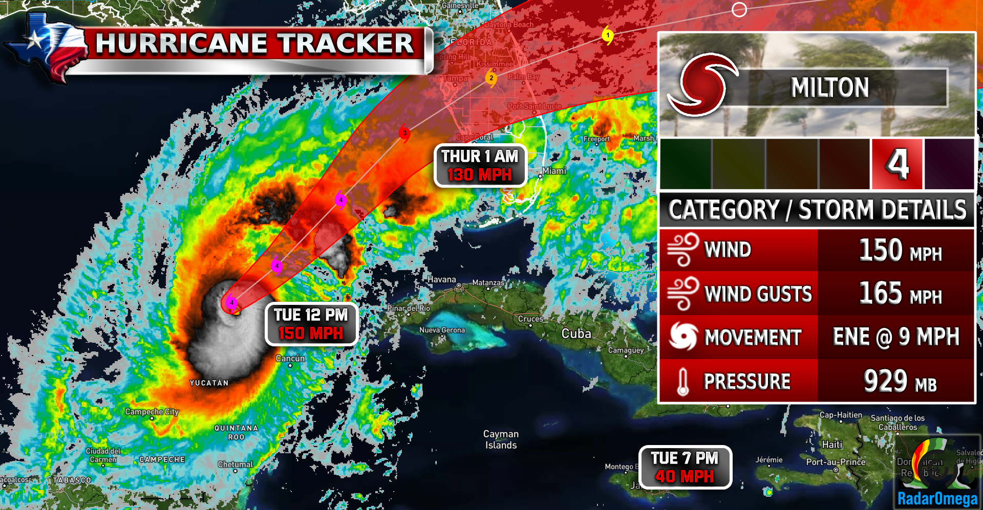
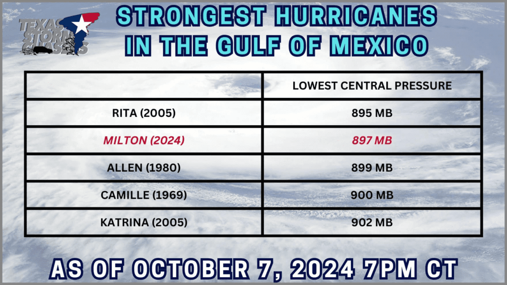
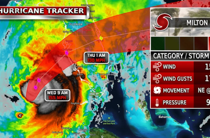
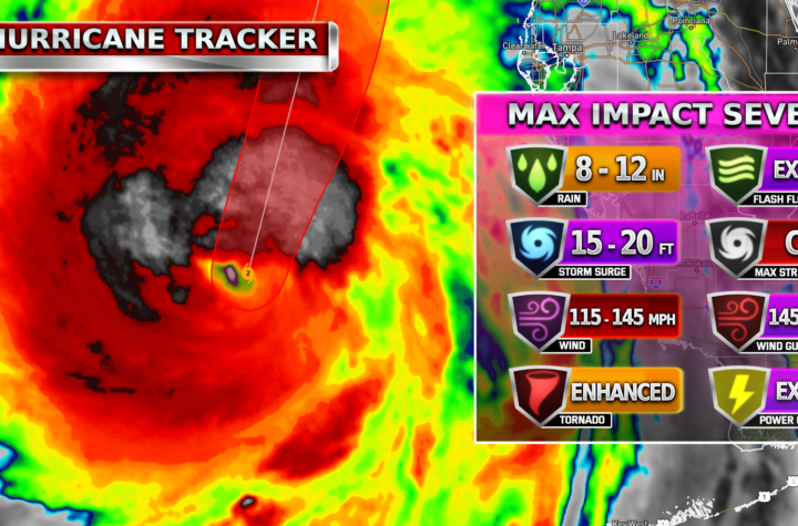
Hurricane Milton, currently a powerful Category 4 storm, has become one of the strongest hurricanes of 2024, with sustained winds reaching a peak of 180 mph. If a CAT 6 hurricane existed, this would qualify, since it has long surpassed the CAT 5 threshold of 157+ MPH. The storm has set new records for wind speeds and low pressure. As of October 7th, Milton had a central pressure of 897 mb, making it the second lowest-pressure hurricane on record for the Gulf of Mexico. This rapid intensification resulted in Milton becoming a life-threatening storm for Florida’s Gulf Coast, with storm surge projections exceeding 15 feet in some areas. The Tampa Bay Florida area is the projected landfall location for Milton. If you have friends and family in that area, please ensure they have evacuated completely.
Milton underwent an eyewall replacement cycle but maintained its strength, with winds contracting and rebounding. Currently, Milton is a CAT 4 with winds of 150 MPH and is expected to weaken to a CAT 3 before landfall. Florida is bracing for catastrophic damage, as the hurricane is expected to bring widespread storm surges, damaging winds, and flooding as it approaches the west-central coast. Experts warn of prolonged power outages and severe structural damage across the region.
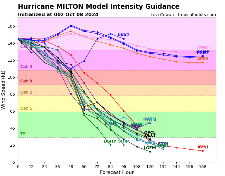
| Simulated Intensity Guidance
| Satellite Imagery
See the latest Satellite Imagery of the southern plains, the US, and the whole disk! See various types of imagery like infrared, water vapor, visible, and more!
| 7-Day Tropical Weather Outlook

Landfall
1 AM Thursday
Current Intensity
CAT 4 / 155 MPH
Previous Max Intensity
CAT 5 / 180 MPH
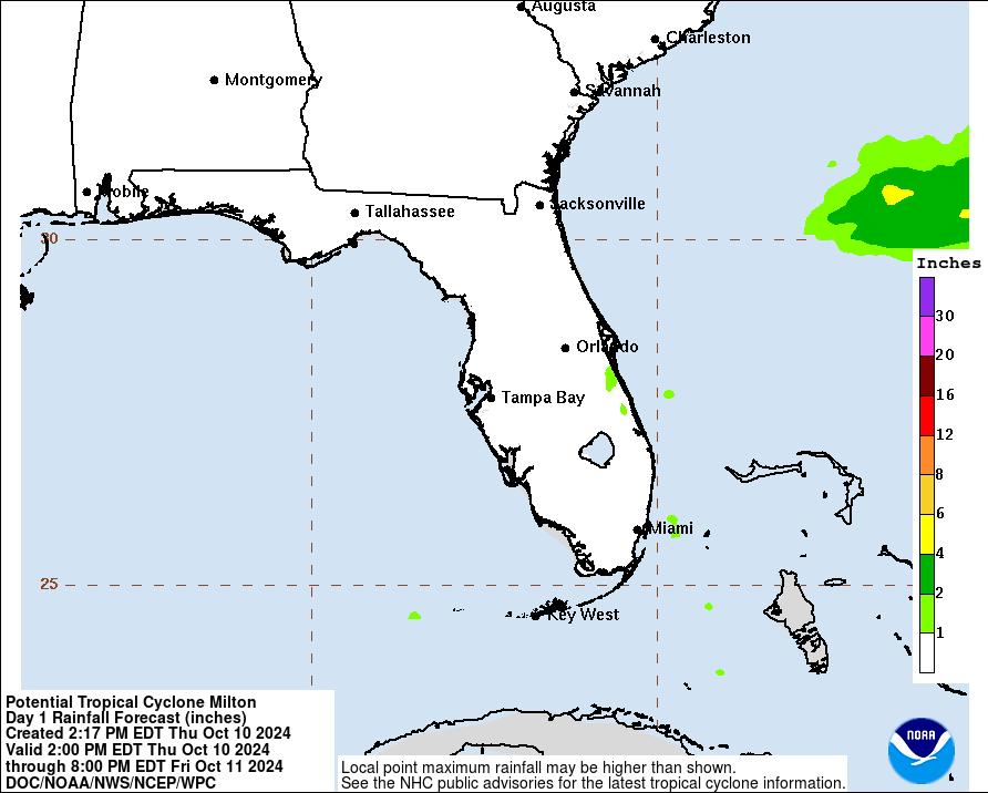
| Rainfall Totals
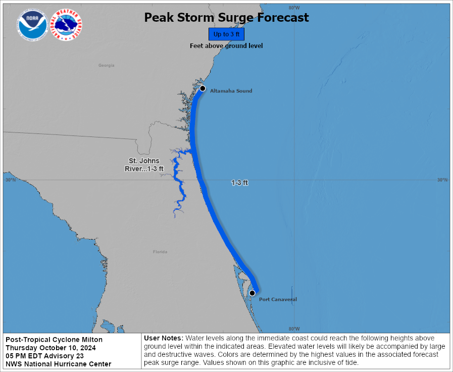
| Peak Storm Surge
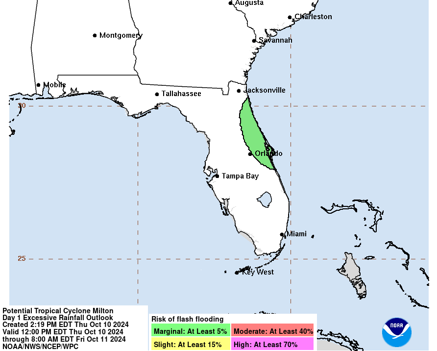
| Flash Flood Outlook
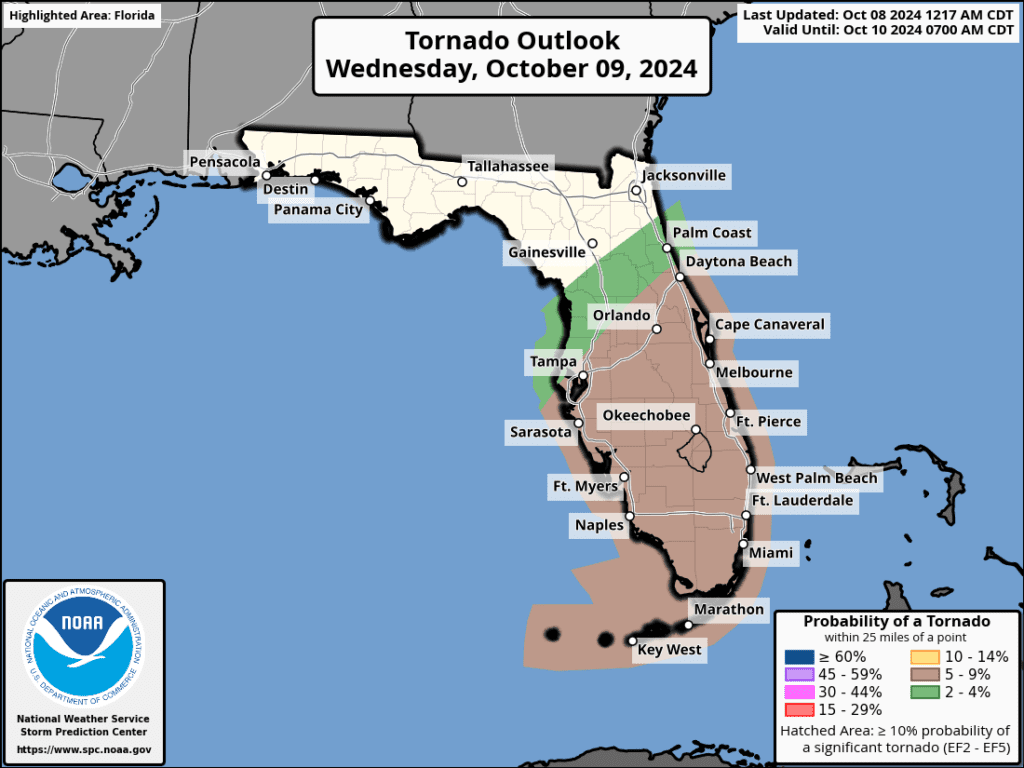
| Tornado Outlook
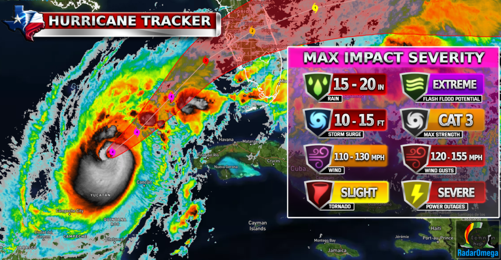
| TWC Info Maps
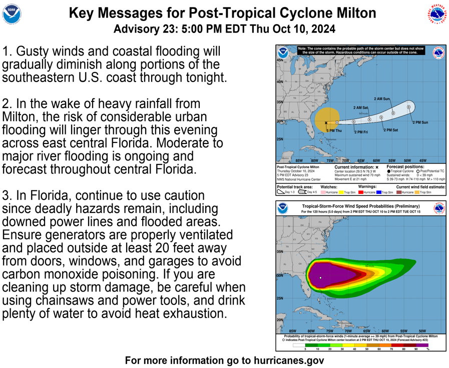
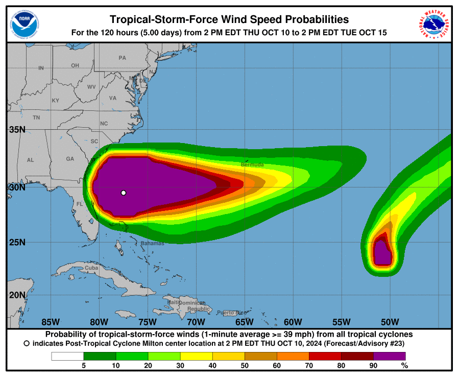
| TS Force Wind Probabilities
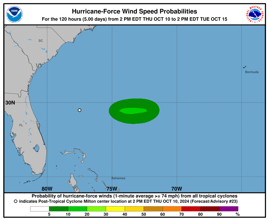
| Hurricane Wind Probabilities
| Tracking Map

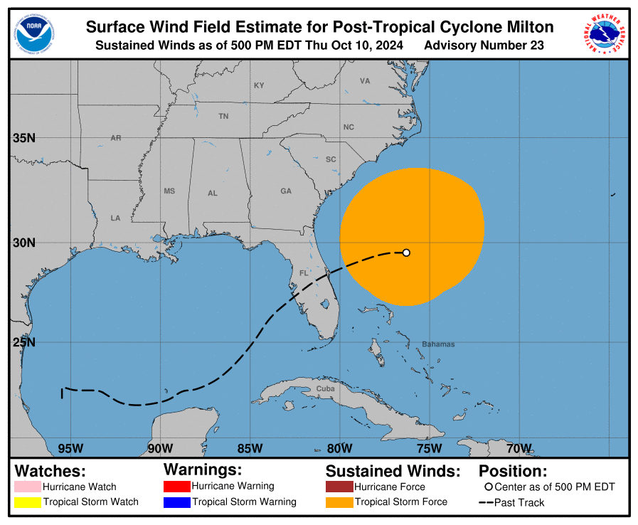
| Warnings / Surface Winds
| Latest IR Satellite Imagery

Become a TWC Member today for FREE!
Support Texas Weather Center
Join the TWC Membership through Patreon to show your support and keep TWC high quality and FREE!
Texas Weather Center Supporters
🥉Kathryn
🥇David Bass
🥉cslewis1234
🥉Robert Fasulo
🥈Carol
Join TWC’s Facebook Group to interact with a community, see the latest updates from TWC, and share your weather photos!
