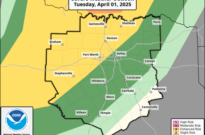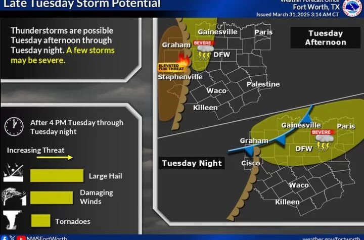
Rain and storm chances are expected to increase on Wednesday as a cold front approaches the region. Some locations will see light rain or drizzle during the morning hours. Windy conditions will continue in the afternoon along with the potential for a few isolated storms. The best window for severe weather is expected to arrive after dark Wednesday as the front moves across the region, between 9 PM and 3 AM (mainly midnight and after).
A few of these storms may be strong or severe with a hail and wind threat. A rising tornado risk is possible as well, but still low. Stay tuned for updates on TWC’s Facebook tomorrow or follow its updates on Live Storm Updates!

2️⃣Slight Risk
![]() Low chance of tornadoes
Low chance of tornadoes![]() Large hail up to 1.5 Inches possible
Large hail up to 1.5 Inches possible![]() Damaging winds up to 70 MPH
Damaging winds up to 70 MPH
Become a TWC Member today for FREE!
Support Texas Weather Center
Join the TWC Membership through Patreon to show your support and keep TWC high quality and FREE!
Texas Weather Center Supporters
🥉Kathryn
🥇David Bass
🥉cslewis1234
🥉Robert Fasulo
🥈Carol
Join TWC’s Facebook Group to interact with a community, see the latest updates from TWC, and share your weather photos!