Winter Storm Watch for DFW
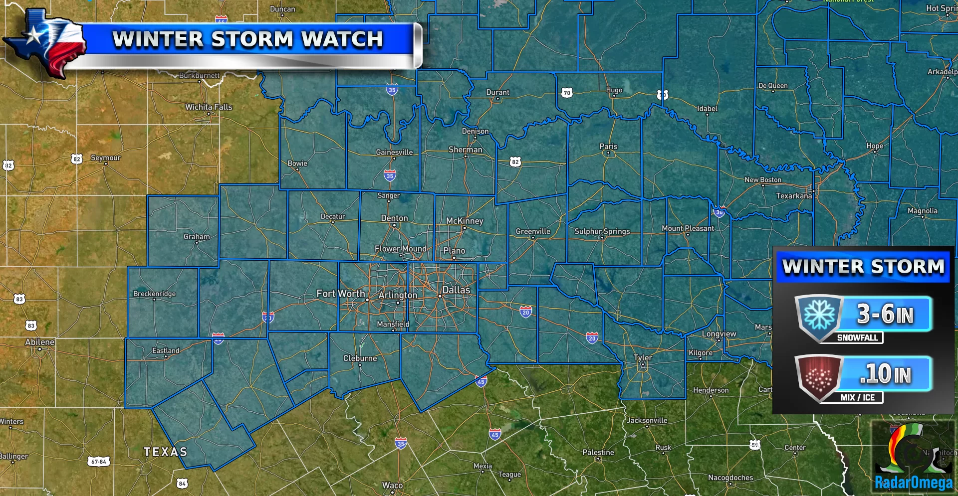
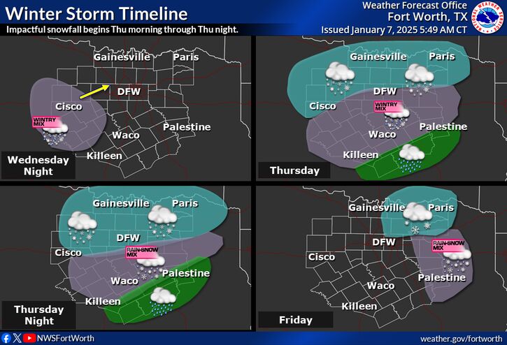
From NWS: Heavy snow and mixed precipitation are possible. Total snow accumulations between 3 and 6 inches and ice accumulations around one-tenth of an inch possible. Roads, and especially bridges and overpasses, will likely become slick and hazardous. Travel could be very difficult to impossible. The hazardous conditions could impact the Thursday morning and evening commutes. Wintry precipitation will start early Thursday morning and increase in intensity and coverage through the day Thursday into Thursday night before tapering off during the day Friday.
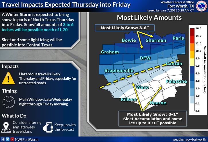
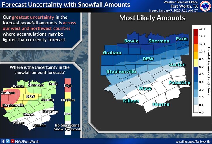
A winter storm watch is currently in effect for much of North Texas extending up northeast into Oklahoma and Arkansas. According to the NWS, snow accumulation will be 3-6 inches for a large portion of the North Texas area with isolated spots receiving 6+ inches of snow. Ice accumulation could also be significant for mostly areas south of I-20 and closer to central Texas like Waco. The main timeframe will be starting late Wednesday night through midday Friday.
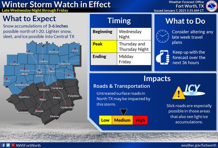
The DFW metroplex is expected to hover around 30-34 degrees the whole day. A few degrees warmer and this whole winter storm will become a different story. TWC is monitoring the temperature forecast closely.
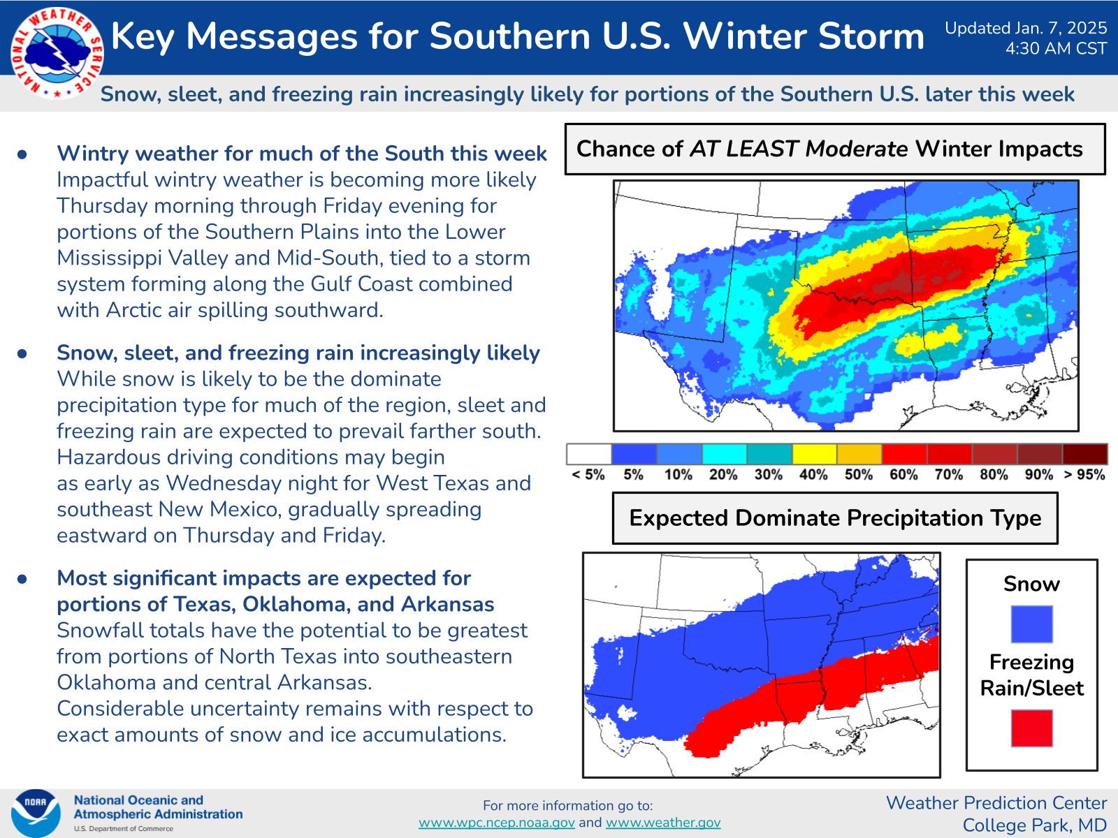
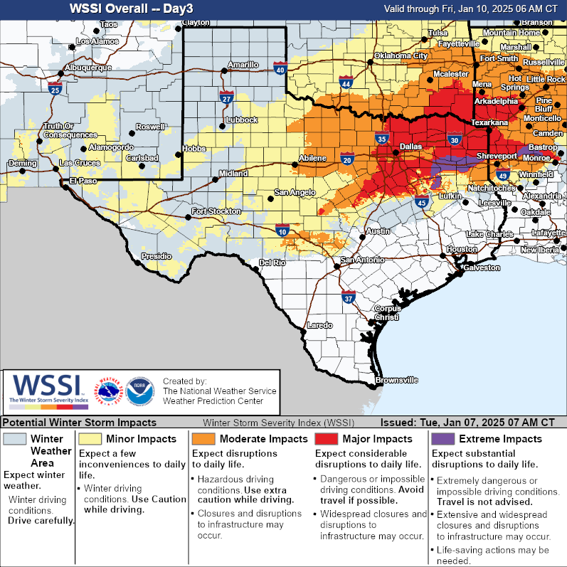
Travel conditions could be extremely hazardous and significant delays may occur, especially on Thursday and Friday. Impacts could last through Saturday depending on high temperatures on Friday. Expect delays with flights from DFW as well starting Wednesday.
Snowfall Accumulation
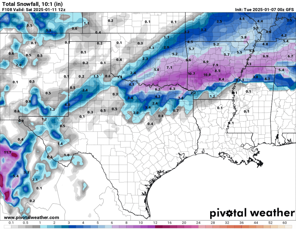
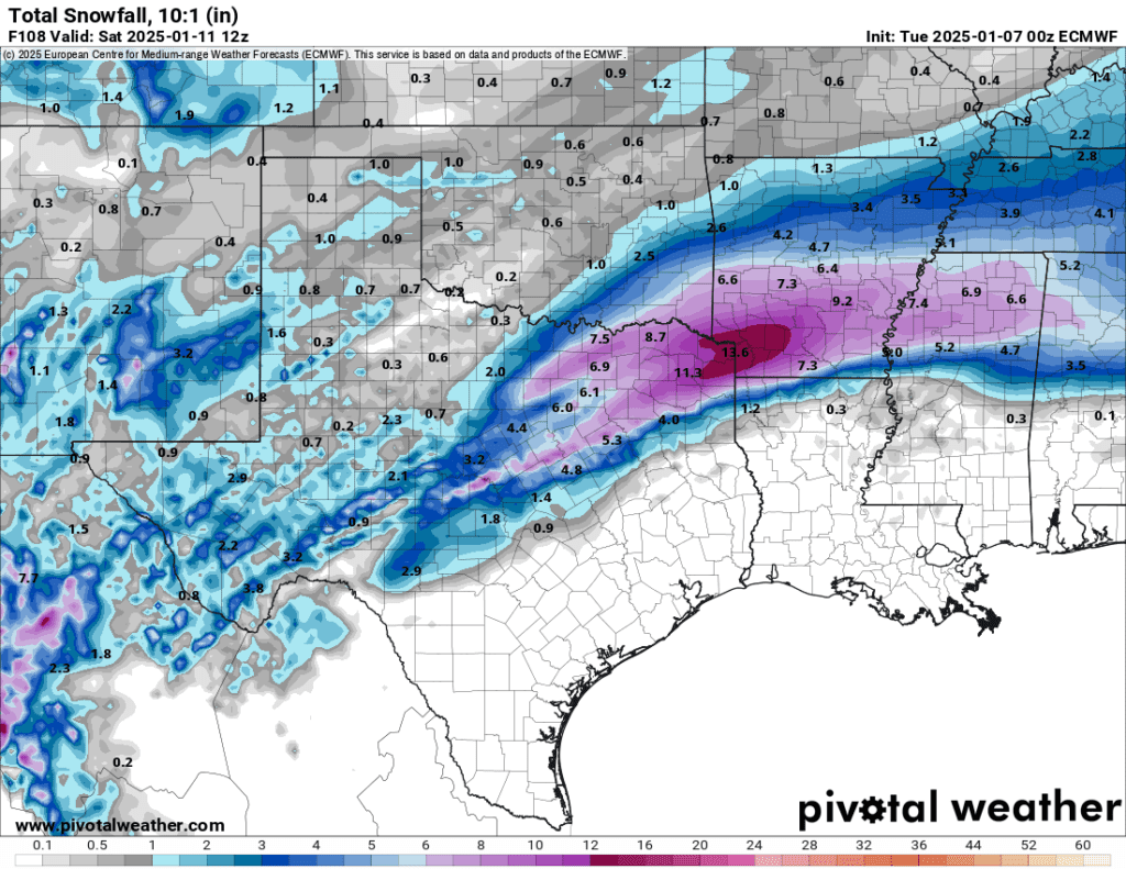
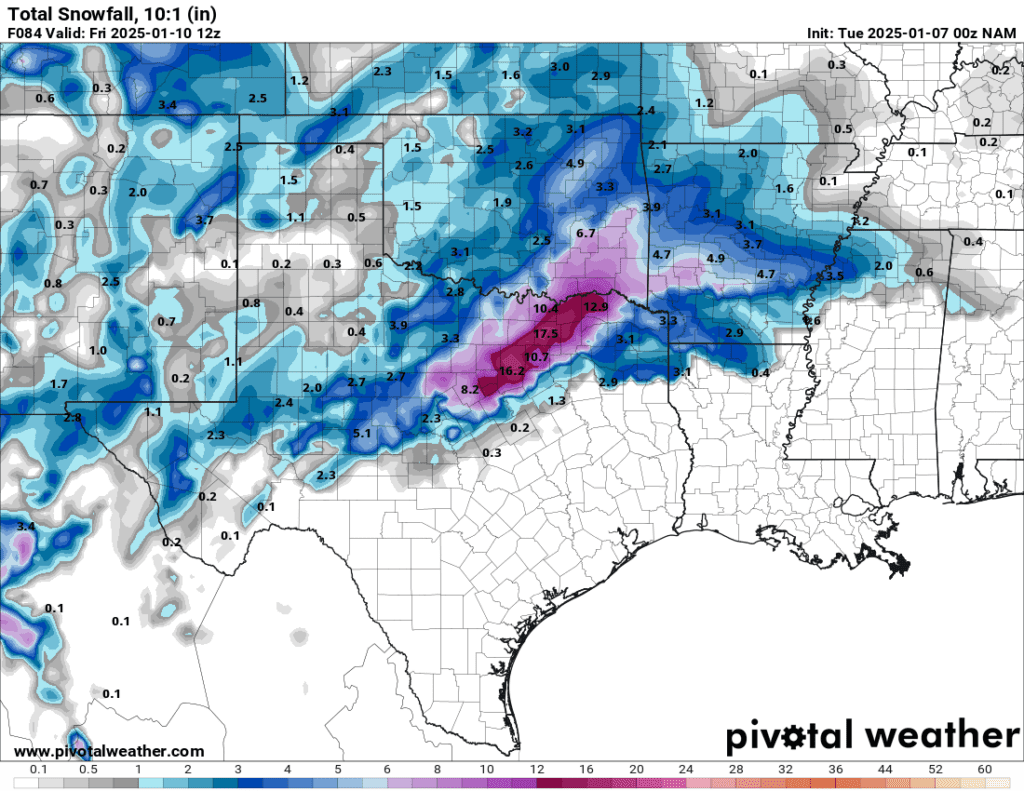
As some of y’all may want to see, here are the latest model runs for snowfall. Below are the GFS, EURO, and NAM models in that order. They all agree on a good amount of snow, but they are still vastly different numbers. Keep in mind that these will change constantly until we get to short-range models which are available about 48 hours away from the event.
Keep in mind these numbers indicate snowfall in inches but don’t necessarily mean accumulation since there will be ground melting, compacting, and evaporation that occurs with the snow.
I recommend we trust the NWS forecast
Power Outage Risk
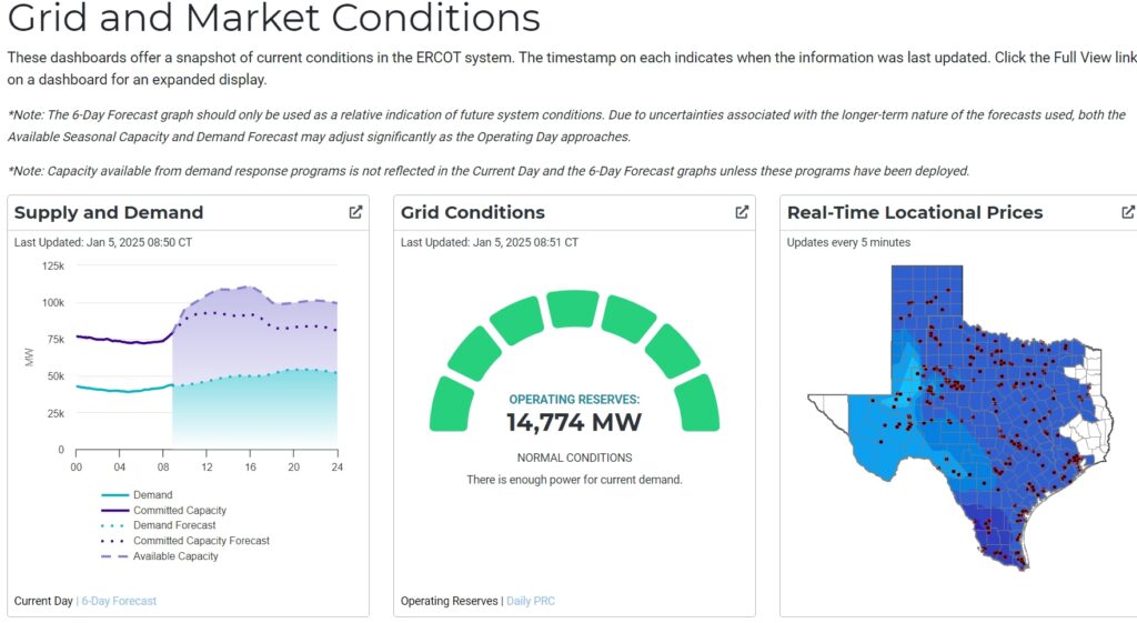
TWC is closely monitoring the current conditions of the grid. Grid conditions are expected to be normal through this winter storm. Follow Ercot live with this interactive dashboard for Texas!
I’ll be watching for the latest model run data and post that when it’s ready. Stay tuned for more updates as model data becomes more refined!
Become a TWC Member today for FREE!
Support Texas Weather Center
Join the TWC Membership through Patreon to show your support and keep TWC high quality and FREE!
Texas Weather Center Supporters
🥉Kathryn
🥇David Bass
🥉cslewis1234
🥉Robert Fasulo
🥈Carol
Join TWC’s Facebook Group to interact with a community, see the latest updates from TWC, and share your weather photos!
