Storms are possible today between 3-8 PM for DFW. Some storms could contain gusty winds and some small hail, but…
Urban Heat Islands (Patreon)
The rise of global temperatures is becoming more and more of a conversational topic through politics and common conversation. TWC…
New TWC Merch / Temperature Outlook
Here comes the cooler weather! Below-average temperatures are expected for the next 6-10 days which means some nice 80-degree weather!…
Recap on Hurricane Beryl
Hurricane Beryl was quite the storm. Below are a few preliminary stats about Beryl. #beryl had a lifetime maximum sustained wind…
Hurricane Beryl Landfall Coverage
What a night. Hurricane Beryl made landfall near Matagorda, TX (85 miles southeast of Houston, TX) as a CAT 1…
Hurricane Beryl Sunday Update
#beryl is now less than 24 hours from landfall in Texas! Beryl is currently a Tropical Storm with winds of…
| WC Tornado Center
View the latest weather models for predicting tornado risk in North Texas today
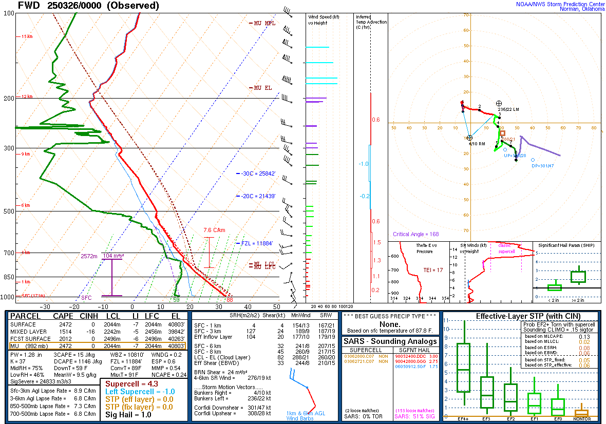
Today’s SPC Weather Sounding
A Weather Sounding is a reading gathered by a weather balloon that creates an atmospherics profile of various kinds of weather data. These soundings (below) gather temperature, dewpoint, moisture, wind speed, wind direction, and various severe storm ingredients present in the atmosphere. All this upper-air data is gathered by radiosondes which are on weather balloons that launch at NWS offices nationwide 2-3 times daily (sometimes dependent on station). This chart may be very confusing and foreign to some. For a tutorial to understand the WC Tornado Center graph below, view WC’s page on “How to Read a Weather Sounding” (coming soon)
Some basic things to look for on a Weather Sounding for tornado forecasting would be:
- Generally high CAPE (Convective Available Potential Energy). Values around 2500+ CAPE is favorable to tornado development due to the high instability in the atmosphere. Find this value under Most Unstable CAPE (MU CAPE)
- K-Index of 26 or higher. K-Index is another method of measuring instability in the atmosphere.
- Lifted Index (LI) of less than -4. Measures the ability for a parcel to lift in the atmosphere.
- Hodograph critical angle as close to 90 degrees as possible. This indicates good wind shear for tornadoes.
- BRN Shear between 20-45 m/s.
- The red temperature line is not overlapping the brown dotted rising air parcel line down closer to the surface. If it was overlapping, it would indicate that there is Convective Inhibition (Inverse CAPE). Whenever this exists, it will prevent severe storm development and the CAPE will hold.
- SARS Sounding Analog indicating matches for SUPERCELL and SGFNT HAIL.
- Any of these categories colored orange or red: Supercell, Left Supercell, STP, and Sig Hail.

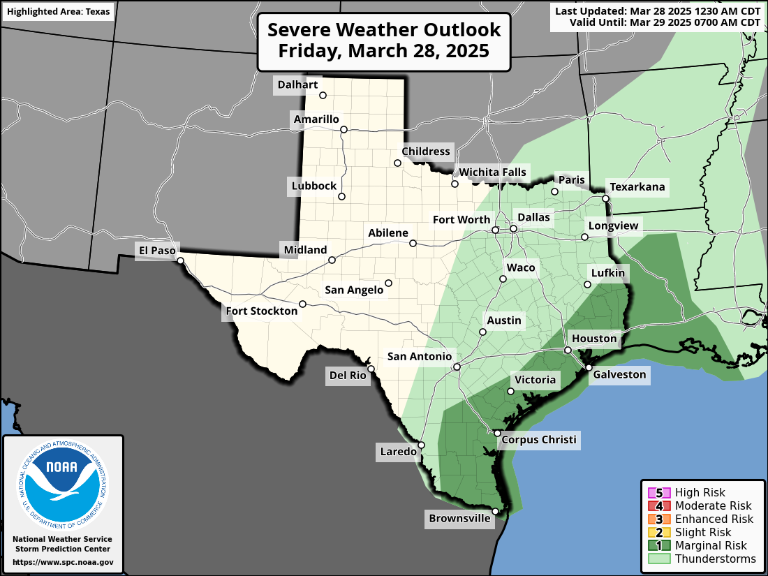
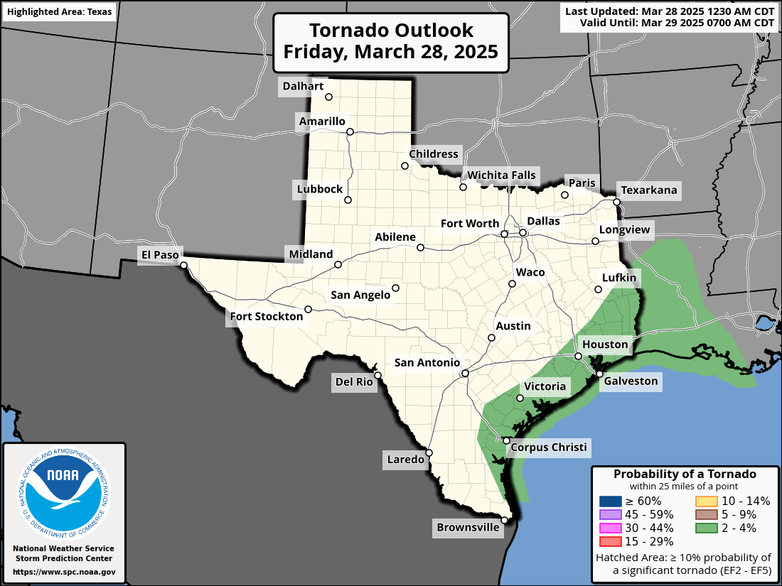
SPC Outlooks

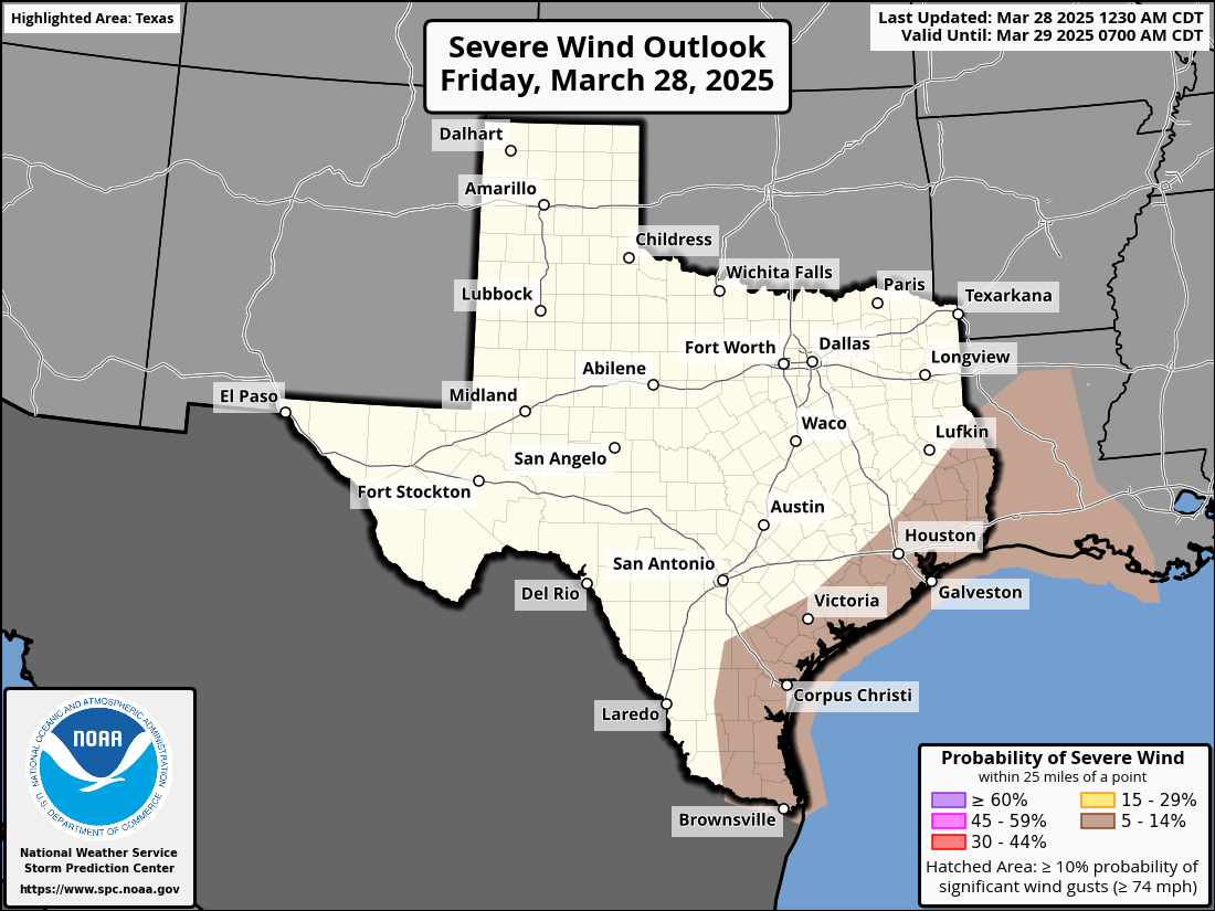
Day 1

Tornado Risk

Wind Risk

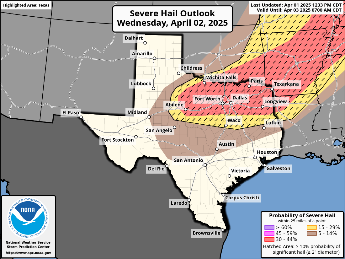
Hail Risk

Discussion

STORM PREDICTION CENTER

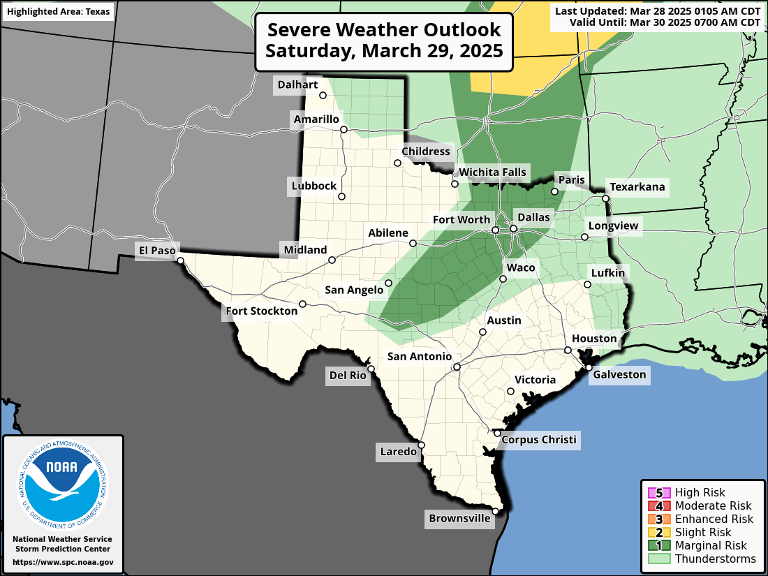
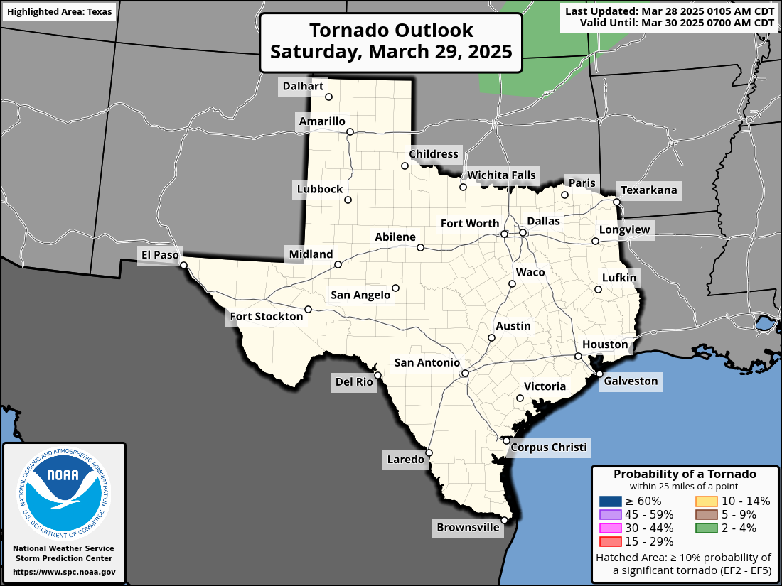
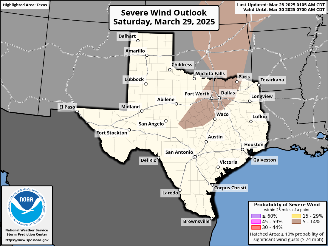
Day 2

Tornado Risk

Wind Risk

Hail Risk

Discussion
STORM PREDICTION CENTER
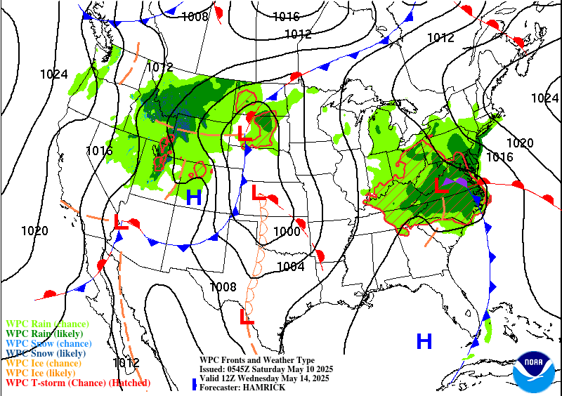
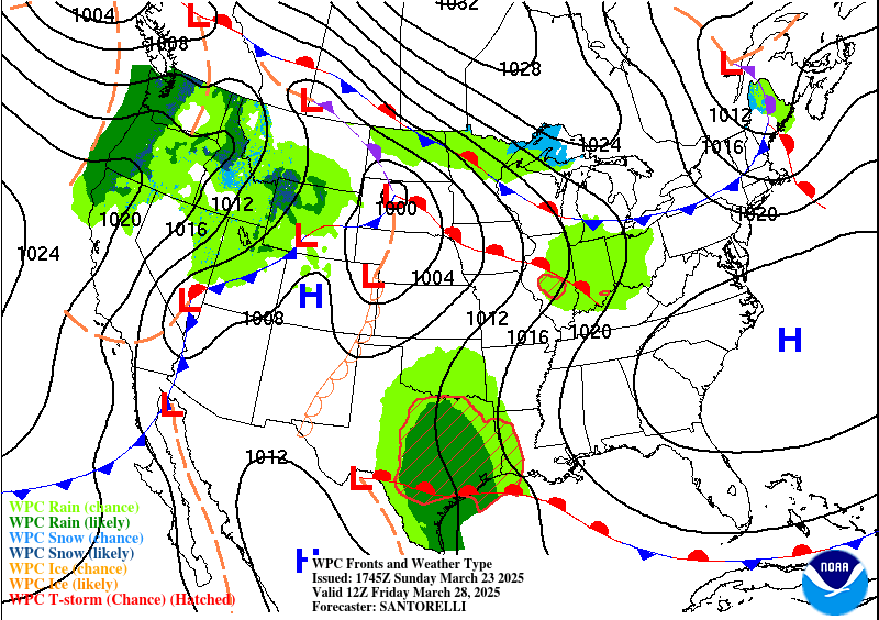
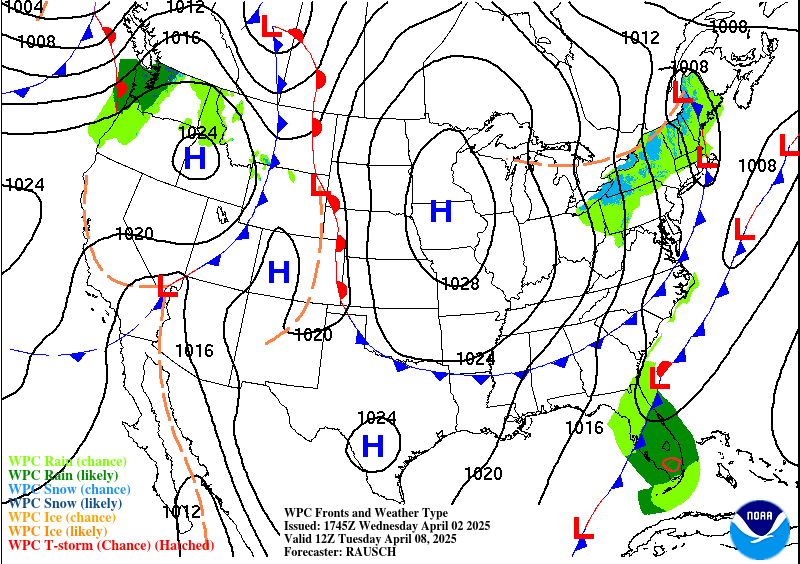
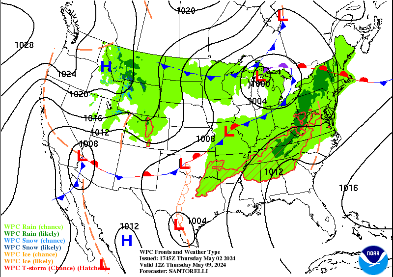
Surface Analysis Conditions
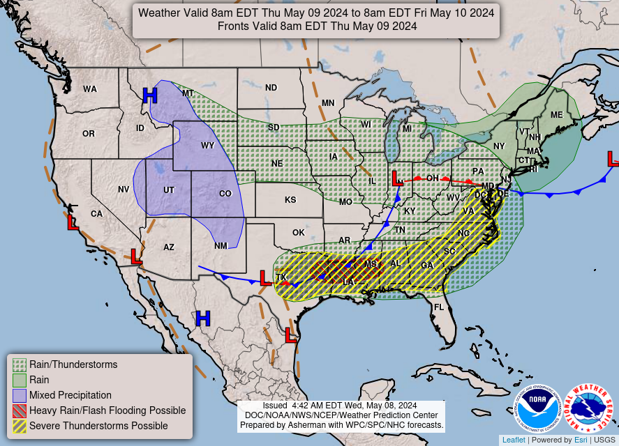
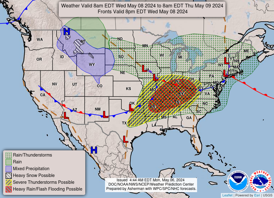
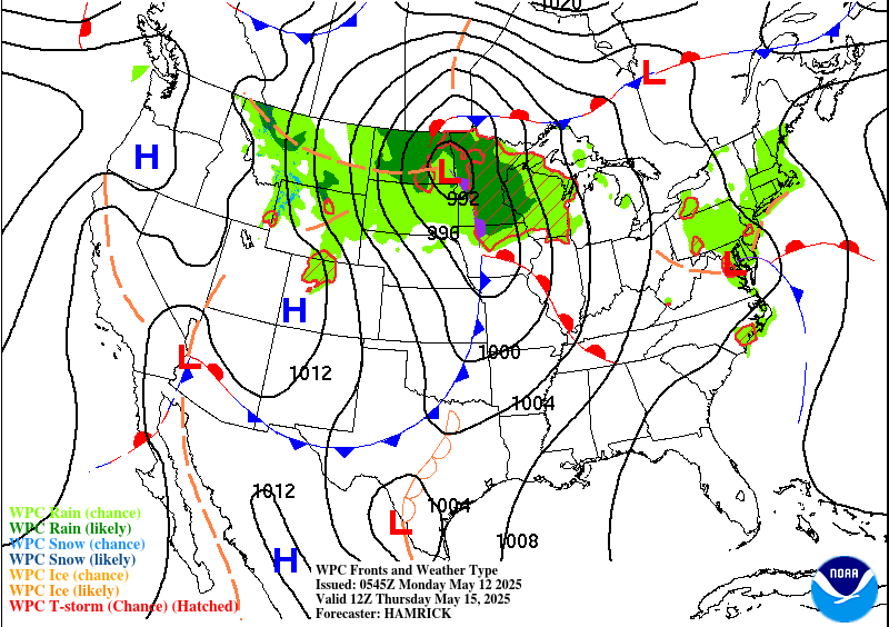
A surface analysis map often tells forecasters what the weather will be like nationwide. It displays some of the basic setups including weather fronts, high low pressure systems, pressure gradients, and various other things.
Some basic things to look for on these maps for tornado forecasting would be:
- Low pressure system
- Cold Front and/or Dry Line system
- Mesocyclonic systems (counterclockwise spin around a Low pressure system)

Day 1

Day 2

Day 3

Day 4

Day 5

Day 6

Day 7

Day 8

Key Tornado Ingredients

Surface Based CAPE

3-Hour CAPE Change

Supercell Composite

Bulk Wind Shear

LCL Height

Total Totals

K-Index

Critical Angle

SR Helicity

Energy-Helicity Index

Significant Tornado

Probability of EF0+

Probability of EF2+

Probability of EF4+
Surface Based CAPE
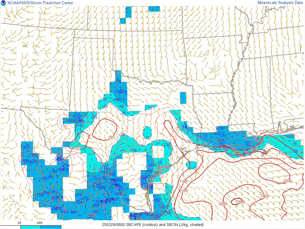
Surface-Based CAPE, or Convective Available Potential Energy, is a term used to quantify the amount of atmospheric energy available for convective thunderstorm development near the Earth’s surface. It is a key parameter for assessing the potential for severe weather, particularly thunderstorms. Surface-Based CAPE values are expressed in joules per kilogram (J/kg), and they provide insight into the instability and likelihood of storm development. Here’s a list of number values associated with Surface-Based CAPE and their interpretations:
- Low CAPE (0-500 J/kg):
- Limited potential for strong or severe thunderstorm development.
- Typically results in less intense convective activity.
- Moderate CAPE (500-1,000 J/kg):
- Favorable for thunderstorms with the potential for heavy rain, lightning, and gusty winds.
- Severe weather is possible but less likely.
- High CAPE (1,000-2,500 J/kg):
- Indicates a substantial potential for severe thunderstorms with intense updrafts.
- Increased risk of severe weather, including large hail, damaging winds, and tornadoes.
- Very High CAPE (2,500 J/kg and above):
- Suggests an extremely unstable atmosphere, with a high potential for severe weather events, including supercells and violent thunderstorms.
Surface-Based CAPE is a valuable tool for meteorologists to assess the atmospheric conditions conducive to thunderstorm development and the potential for severe weather.
3-Hour CAPE Change
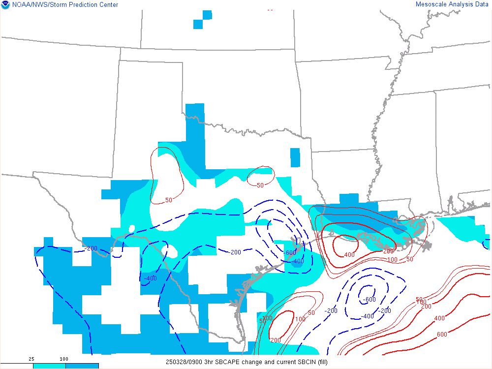
3-hour CAPE change refers to the assessment of Convective Available Potential Energy (CAPE) over a three-hour time frame. CAPE is a critical meteorological parameter that quantifies the atmospheric energy available for the development of thunderstorms. A change in CAPE over a short period can indicate significant shifts in atmospheric instability, which is crucial for forecasting severe weather. Here’s a list of number values associated with 3-hour CAPE change and their implications:
- Positive Change (in joules per kilogram, J/kg):
- A positive value indicates an increase in CAPE over the past three hours.
- Suggests growing atmospheric instability, raising the potential for thunderstorm development.
- Negative Change (in J/kg):
- A negative value signifies a decrease in CAPE within the last three hours.
- Indicates a reduction in atmospheric instability and a potential decline in the likelihood of thunderstorms.
- Zero Change (0 J/kg):
- A value of zero implies little to no change in CAPE during the specified time frame.
Meteorologists use 3-hour CAPE change to monitor the dynamic nature of atmospheric instability and its impact on thunderstorm development. Significant changes can influence the severity of weather events, including the likelihood of severe storms, hail, and tornadoes.
Supercell Composite
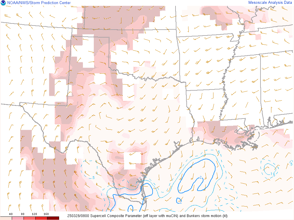
The Supercell Composite is an index designed to assess the potential for supercell thunderstorm development. Supercells are severe thunderstorms characterized by rotating updrafts, often associated with tornadoes, large hail, and damaging winds. This index combines various atmospheric parameters to gauge the likelihood of supercell formation. Here’s a list of number values associated with the Supercell Composite and their interpretations:
- Low Value (0-1):
- Suggests a low likelihood of supercell thunderstorms.
- Typically indicates less favorable conditions for severe weather.
- Moderate Value (1-3):
- A moderate potential for supercell development.
- Indicates the possibility of severe weather with rotating updrafts.
- High Value (3-6):
- Suggests a significant potential for supercell thunderstorms.
- Indicates a heightened risk of severe weather events, including tornadoes.
- Very High Value (6 and above):
- Signifies an extremely favorable environment for supercell development.
- Suggests a high risk of severe weather, often with strong and long-lived tornadoes.
Meteorologists rely on the Supercell Composite to anticipate and monitor conditions conducive to supercell thunderstorms, enhancing the accuracy of severe weather forecasts and helping to issue timely warnings.
Bulk Wind Shear
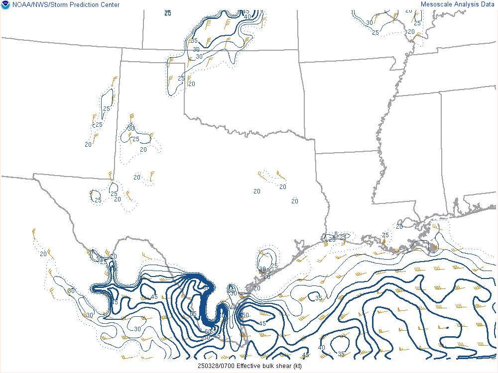
Bulk Wind Shear is the change in wind speed or direction in the lower part of the atmosphere where storm development will first develop (first 3.5 miles). This map displays the effective values. Any values 40 Knots or more is favorable environment for supercell development. The larger the number, the more shear there is which results in better potential for supercell development.
Some basic things to look for on these maps for tornado forecasting would be:
- Bulk Shear values of 40+ Knots
LCL Height
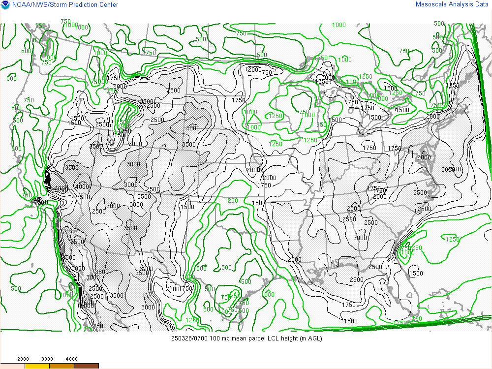
The Lifted Condensation Level (LCL) Height is a critical parameter that helps in assessing cloud base heights and the potential for cloud formation. It represents the altitude at which a parcel of moist air, when lifted, cools to the point where its relative humidity reaches 100%, and condensation occurs, forming clouds. LCL height is vital for forecasting and understanding cloud development and weather patterns. Here’s a list of number values associated with LCL height and their implications:
- Low LCL Height (below 1,000 meters):
- Suggests cloud formation and potential for low-level clouds.
- Often related to localized weather phenomena and cooler conditions near the surface.
- Moderate LCL Height (1,000-2,500 meters):
- Typical for the development of mid-level clouds.
- Often associated with more stable and less convective atmospheric conditions.
- High LCL Height (above 2,500 meters):
- Signifies cloud formation at higher altitudes.
- Indicates potential for convective storms, towering cumulus clouds, and more dynamic atmospheric conditions.
Meteorologists use LCL height to gauge the altitude at which cloud bases and potential precipitation events may occur, aiding in weather forecasting and understanding vertical atmospheric structure.
Total Totals
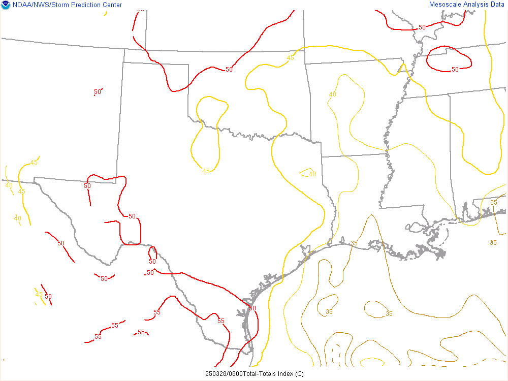
Total Totals (TT) is an index used to assess atmospheric instability and the potential for severe weather, especially convective storms. It is calculated by adding two temperature values and subtracting the dew point temperature. TT values help meteorologists determine the likelihood of thunderstorm development and severe weather. Here’s a list of number values associated with Total Totals and their interpretations:
- Low TT (below 40):
- Indicates limited atmospheric instability and a lower potential for severe weather.
- Suggests a lower likelihood of intense thunderstorms.
- Moderate TT (40-50):
- Suggests a moderate level of atmospheric instability.
- A moderate chance of thunderstorm development, potentially leading to strong storms.
- High TT (50-55):
- Signifies a higher level of atmospheric instability.
- An increased potential for severe weather events, including strong thunderstorms.
- Very High TT (above 55):
- Indicates an extremely unstable atmosphere with a significant potential for severe weather.
- Suggests a high likelihood of severe storms, including hail, strong winds, and possible tornadoes.
Meteorologists use Total Totals to assess the degree of atmospheric instability, helping to predict and monitor the potential for severe weather and thunderstorm development.
K-Index
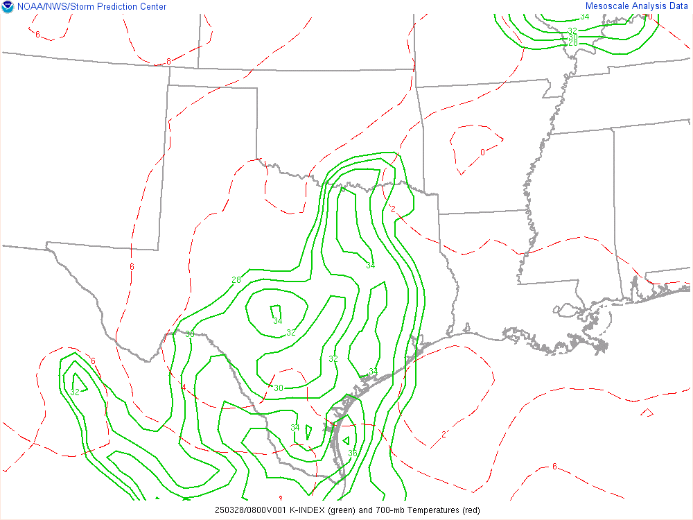
The K-index is a valuable parameter used to evaluate atmospheric stability and the potential for thunderstorm development. It helps meteorologists assess the likelihood of severe weather and provides crucial information for weather forecasting. The K-index combines various atmospheric measurements to gauge atmospheric instability, including temperature, dew point, and wind data. Here’s a list of number values associated with the K-index and their implications:
- Low K-index (0-15):
- Indicates a stable atmosphere with limited potential for thunderstorms.
- Suggests relatively calm and benign weather conditions.
- Moderate K-index (15-25):
- Signifies a moderately unstable atmosphere with a moderate potential for thunderstorm development.
- Suggests a chance of scattered or non-severe thunderstorms.
- High K-index (25-35):
- Indicates a higher level of atmospheric instability.
- Suggests an increased likelihood of severe weather, including strong thunderstorms.
- Very High K-index (above 35):
- Signifies an extremely unstable atmosphere.
- Predicts a high likelihood of severe weather events, such as large hail, damaging winds, and tornadoes.
The K-index is a critical tool for meteorologists as it helps in identifying regions of potential convective activity and severe weather, especially when combined with other meteorological indices. High K-index values are often associated with warm, moist air masses, which provide the necessary conditions for strong thunderstorm development. By monitoring the K-index, meteorologists can issue timely warnings and advisories to keep the public informed and safe during severe weather events.
Critical Angle
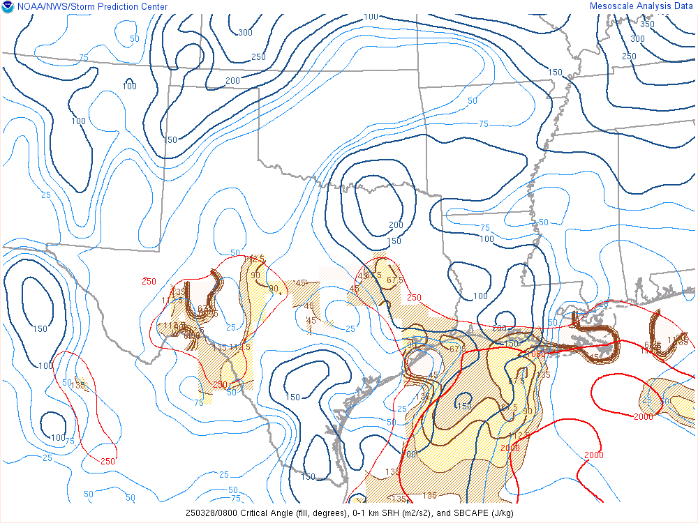
The Critical Angle refers to the angle at which a low-level wind approaching an area of severe weather must intersect with storm motion to maximize the potential for supercell thunderstorm development and tornado formation. This concept is essential for understanding atmospheric conditions conducive to severe weather and tornadoes. Here’s a list of number values associated with the Critical Angle and their implications:
- Small Critical Angle (0-30 degrees):
- A small angle suggests that low-level winds are nearly aligned with the storm’s motion.
- This configuration can enhance the potential for supercell thunderstorms and increase the risk of tornadoes.
- Moderate Critical Angle (30-60 degrees):
- A moderate angle indicates that low-level winds approach the storm at an angle.
- This scenario offers a reasonable chance for supercell development and tornadoes but may not be as conducive as a smaller critical angle.
- Large Critical Angle (60-90 degrees):
- A large critical angle suggests that low-level winds intersect the storm’s motion at a significant angle.
- This configuration is less favorable for supercell and tornado development.
The Critical Angle is a key tool in meteorology, particularly when assessing the likelihood of severe weather events. When the critical angle is small, it signifies a more favorable environment for supercells and tornadoes, as the winds are better aligned to enhance storm rotation and updrafts. Meteorologists use this parameter to issue warnings and advisories, helping communities prepare for potentially dangerous weather conditions. Understanding the critical angle is crucial in improving the accuracy of weather forecasts and increasing the lead time for tornado warnings.
SR Helicity
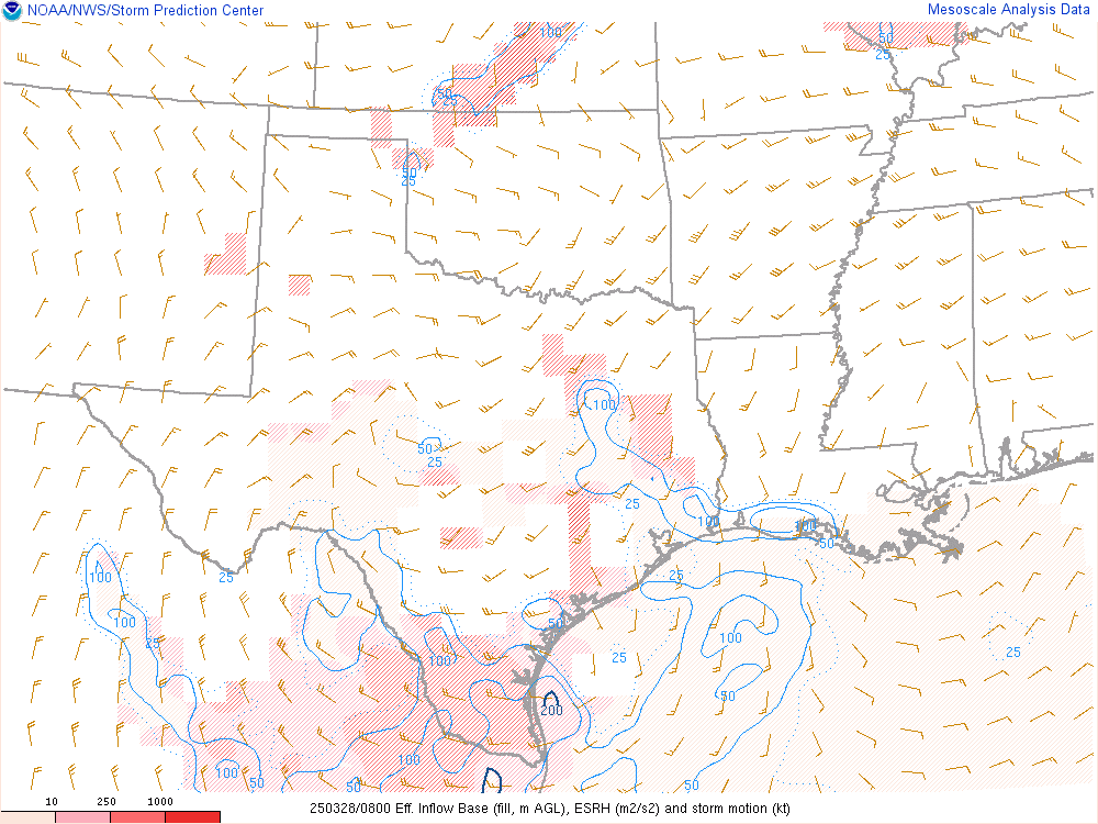
In the realm of meteorology, SR helicity, or Storm-Relative Helicity, is a critical parameter used to assess the potential for rotating updrafts within severe thunderstorms. It quantifies the relative spin in the atmosphere by considering the vertical wind shear and storm motion in a given region. High SR helicity values indicate a favorable environment for the development of supercell thunderstorms. Storm-Relative Helicity (SRH) is such a crucial parameter in that helps assess the potential for rotating updrafts in thunderstorms. SRH values provide insight into the atmosphere’s propensity for severe weather, particularly tornadoes. Here’s a general list of what different SR Helicity numbers may imply:
- Low SR Helicity (0-100 m²/s²):
- Limited or no potential for rotating updrafts.
- Thunderstorms are less likely to produce tornadoes.
- Moderate SR Helicity (100-200 m²/s²):
- A modest potential for rotating updrafts.
- Isolated tornadoes may be possible but not guaranteed.
- High SR Helicity (200-400 m²/s²):
- A significant potential for rotating updrafts.
- Conditions are favorable for supercell development and tornado formation.
- Very High SR Helicity (400 m²/s² and above):
- An extremely favorable environment for rotating updrafts.
- Increased likelihood of strong and long-lived tornadoes.
It’s important to note that SR Helicity is just one of several factors meteorologists consider when assessing severe weather potential, and its interpretation can vary depending on the specific storm and regional conditions.
Energy-Helicity Index
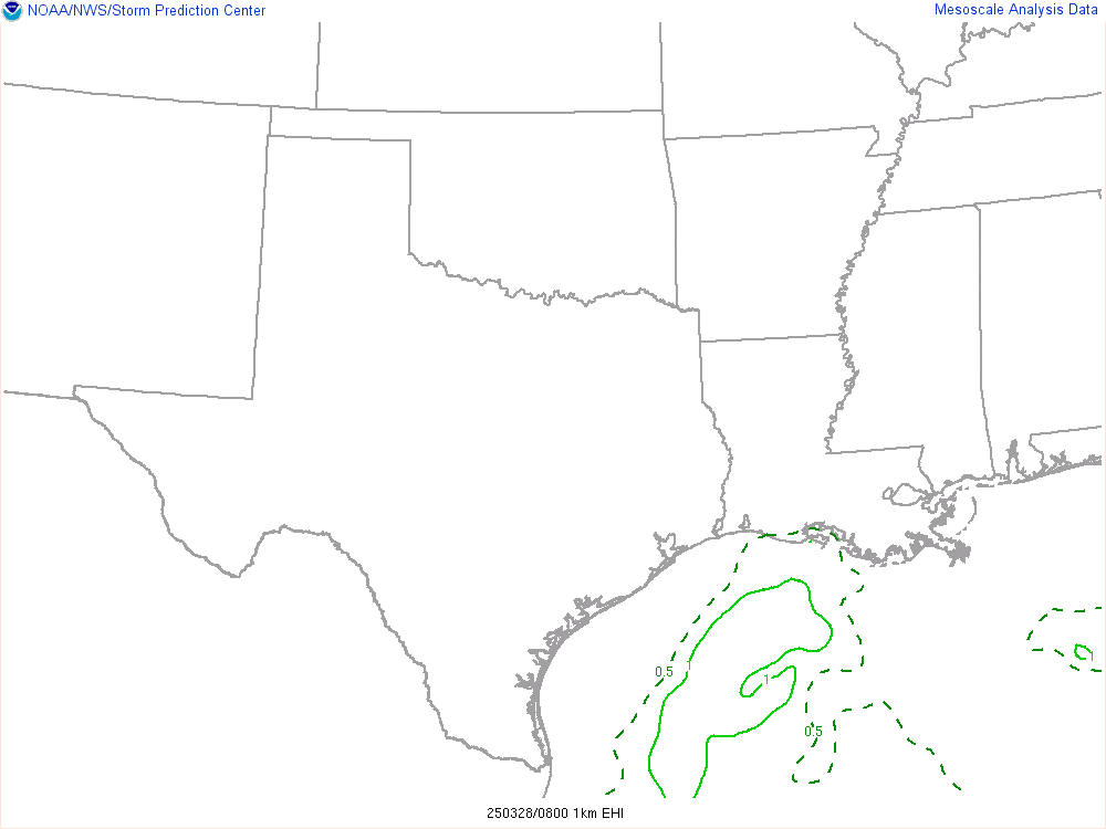
The Energy-Helicity Index (EHI) is a meteorological parameter that combines measures of both convective available potential energy (CAPE) and helicity. It is used to assess the potential for supercell thunderstorm development and tornado formation. The EHI provides valuable insights into the atmospheric conditions conducive to severe weather events. Here’s a list of number values associated with the Energy-Helicity Index and their interpretations:
- Low EHI (0-1):
- Suggests a minimal potential for supercell thunderstorms and tornadoes.
- Typically indicates less favorable conditions for severe weather.
- Moderate EHI (1-5):
- Signifies a moderate potential for supercell development and tornadoes.
- Suggests the possibility of severe weather events.
- High EHI (5-10):
- Indicates a significant potential for supercell thunderstorms and tornadoes.
- Suggests a heightened risk of severe weather, including the formation of strong tornadoes.
- Very High EHI (10 and above):
- Signifies an extremely favorable environment for supercell development and severe weather.
- Suggests a high risk of severe weather events, with the potential for violent, long-lived tornadoes.
Meteorologists use the Energy-Helicity Index to assess the combination of energy available for storm development (CAPE) and the rotation and vorticity in the atmosphere (helicity). A higher EHI value indicates a greater likelihood of severe weather, with the potential for supercells and tornadoes. This information is crucial for issuing timely warnings and advisories to protect communities from the destructive forces of severe weather. Understanding the EHI improves the accuracy of severe weather forecasting and helps reduce the impact of these events on society.
Significant Tornado
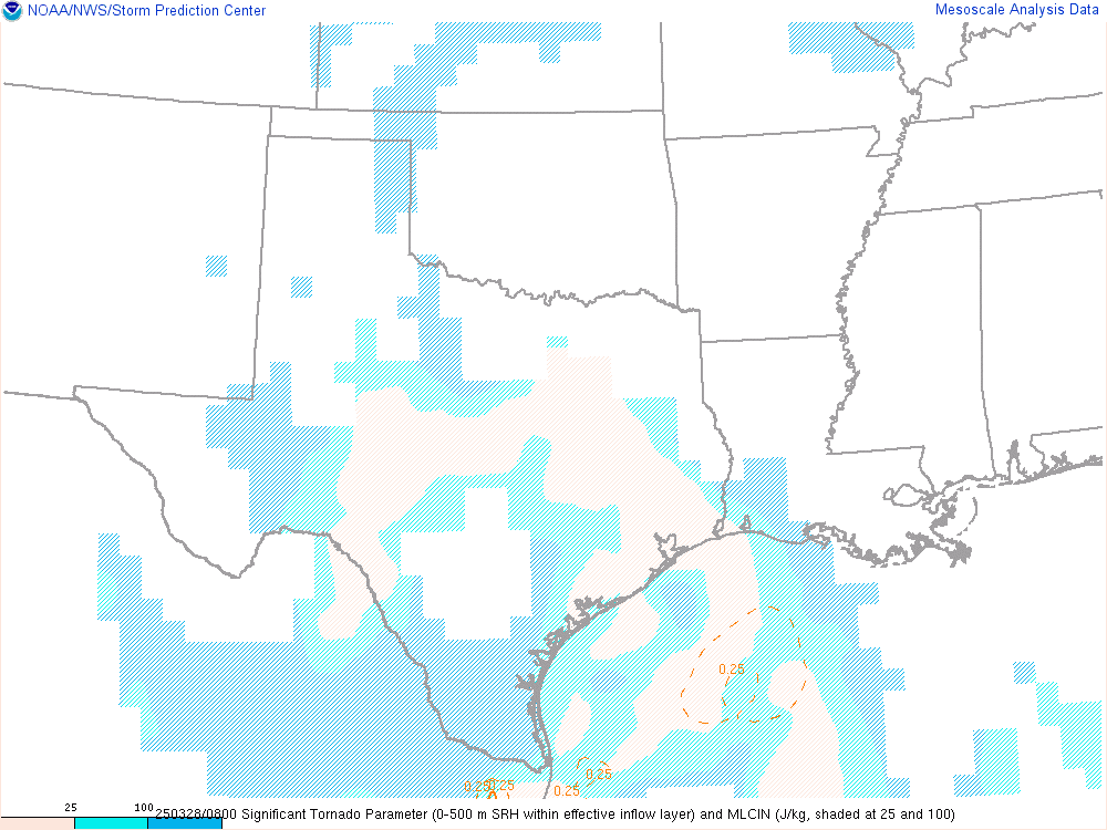
The Significant Tornado parameter, often referred to as SigTornado, is an index used to assess the potential for significant and violent tornadoes within a severe thunderstorm or supercell. Tornadoes are among the most destructive and life-threatening weather phenomena, and predicting their severity is crucial for public safety and preparedness. Here’s a list of number values associated with the Significant Tornado parameter and their interpretations:
- Low SigTornado (0-1):
- Suggests a low likelihood of significant tornado development.
- Typically indicative of benign or non-severe weather conditions.
- Moderate SigTornado (1-3):
- Indicates a moderate potential for significant tornadoes.
- Suggests a chance of isolated or non-severe tornado events.
- High SigTornado (3-6):
- Signifies a substantial likelihood of significant tornado development.
- Implies an increased risk of tornadoes, including potentially strong ones.
- Very High SigTornado (above 6):
- Indicates an extremely favorable environment for significant and violent tornadoes.
- Suggests a high risk of severe tornado events, including long-lived and violent ones.
Meteorologists use the Significant Tornado parameter to assess the potential for tornadoes and their severity. Higher SigTornado values suggest a more favorable environment for the development of significant tornadoes. Understanding this parameter is critical for issuing accurate tornado warnings and advisories, enhancing public safety, and minimizing the impact of these destructive events.
Probability of EF0+
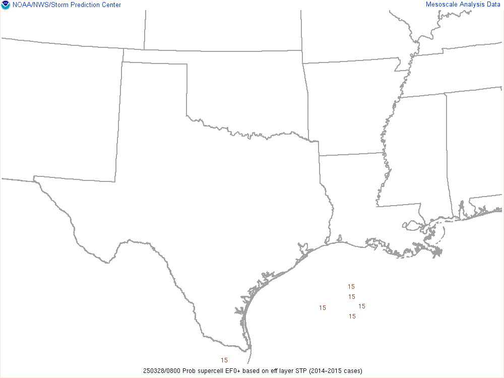
The Probability of EF-0 Tornado is a meteorological parameter used to estimate the likelihood of a tornado occurring at the EF-0 intensity level on the Enhanced Fujita (EF) scale. EF-0 tornadoes are the weakest on the scale, with wind speeds between 65 and 85 miles per hour (105-137 km/h). While they are less destructive than stronger tornadoes, EF-0 tornadoes can still cause damage to buildings and vegetation. Here’s a list of number values associated with the Probability of EF-0 Tornado and their implications:
- Low Probability (0-10%):
- Suggests a low chance of an EF-0 tornado occurring.
- Typically indicative of non-severe or benign weather conditions.
- Moderate Probability (10-30%):
- Indicates a moderate chance of an EF-0 tornado.
- Suggests the potential for isolated EF-0 tornadoes within a given area.
- High Probability (30-50%):
- Signifies a substantial likelihood of EF-0 tornado development.
- Implies an increased risk of EF-0 tornadoes, often associated with severe weather events.
- Very High Probability (above 50%):
- Indicates an extremely favorable environment for EF-0 tornadoes.
- Suggests a high risk of EF-0 tornadoes, often associated with more significant severe weather outbreaks.
Meteorologists use the Probability of EF-0 Tornado to assess the potential for tornadoes at this lower intensity level. Higher values suggest a greater likelihood of EF-0 tornadoes, often linked to convective storm systems. Understanding this parameter helps in issuing accurate tornado warnings and advisories, enhancing public safety, and minimizing property and crop damage.
Probability of EF2+

The Probability of EF-2 Tornado is a meteorological parameter used to estimate the likelihood of a tornado occurring at the EF-2 intensity level on the Enhanced Fujita (EF) scale. EF-2 tornadoes are characterized by wind speeds between 111 and 135 miles per hour (179-217 km/h) and can cause significant damage to buildings and vegetation. Here’s a list of number values associated with the Probability of EF-2 Tornado and their implications:
- Low Probability (0-10%):
- Suggests a low chance of an EF-2 tornado occurring.
- Typically indicative of non-severe or benign weather conditions.
- Moderate Probability (10-30%):
- Indicates a moderate chance of an EF-2 tornado.
- Suggests the potential for isolated EF-2 tornadoes within a given area.
- High Probability (30-50%):
- Signifies a substantial likelihood of EF-2 tornado development.
- Implies an increased risk of EF-2 tornadoes, often associated with severe weather events.
- Very High Probability (above 50%):
- Indicates an extremely favorable environment for EF-2 tornadoes.
- Suggests a high risk of EF-2 tornadoes, often associated with more significant severe weather outbreaks.
Meteorologists use the Probability of EF-2 Tornado to assess the potential for tornadoes at this intensity level, which can lead to notable property damage. Higher values suggest a greater likelihood of EF-2 tornadoes, often linked to convective storm systems. Understanding this parameter helps in issuing accurate tornado warnings and advisories, enhancing public safety, and minimizing property and crop damage.
Probability of EF4+
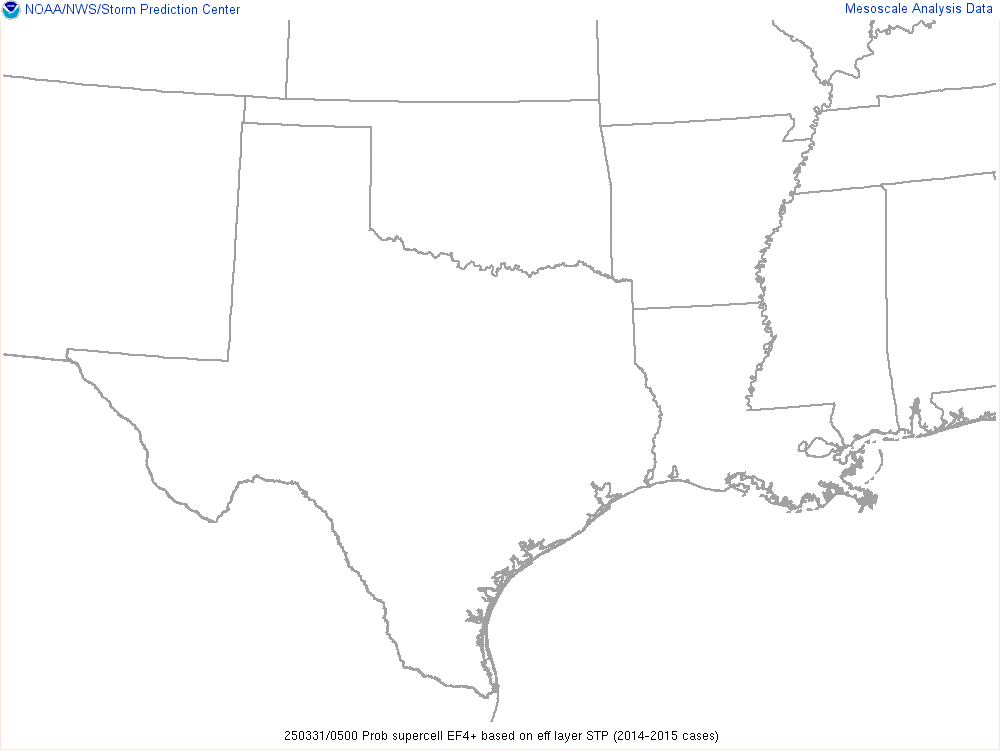
The Probability of EF-4 Tornado is a meteorological parameter used to assess the likelihood of a tornado occurring at the EF-4 intensity level on the Enhanced Fujita (EF) scale. EF-4 tornadoes are characterized by violent wind speeds ranging from 166 to 200 miles per hour (267-322 km/h). These tornadoes can cause extensive damage to buildings and landscapes and pose a significant threat to life and safety. Here’s a list of number values associated with the Probability of EF-4 Tornado and their implications:
- Low Probability (0-10%):
- Suggests a low chance of an EF-4 tornado occurring.
- Typically indicative of non-severe or benign weather conditions.
- Moderate Probability (10-30%):
- Indicates a moderate chance of an EF-4 tornado.
- Suggests the potential for isolated EF-4 tornadoes within a given area.
- High Probability (30-50%):
- Signifies a substantial likelihood of EF-4 tornado development.
- Implies an increased risk of EF-4 tornadoes, often associated with severe weather events.
- Very High Probability (above 50%):
- Indicates an extremely favorable environment for EF-4 tornadoes.
- Suggests a high risk of EF-4 tornadoes, often linked to significant and severe weather outbreaks.
Meteorologists use the Probability of EF-4 Tornado to assess the potential for these violent tornadoes, which can result in catastrophic damage. Higher values indicate a greater likelihood of EF-4 tornadoes, often associated with intense and destructive supercell thunderstorms. Understanding this parameter is crucial for issuing accurate tornado warnings and advisories, enhancing public safety, and minimizing the impact of these severe events.


